
Phone +1 703-771-3417 | ||
 | ||
Address 825 E Market St, Leesburg, VA 20176, USA Hours Open today · Open 24 hoursSaturdayOpen 24 hoursSundayOpen 24 hoursMondayOpen 24 hoursTuesdayOpen 24 hoursWednesdayOpen 24 hoursThursdayOpen 24 hoursFridayOpen 24 hoursSuggest an edit Similar Lansdow On the Potomac, Us FAA, Lansdow Town Center, Dulles Internatio Airport, Federal Aviation Administr | ||
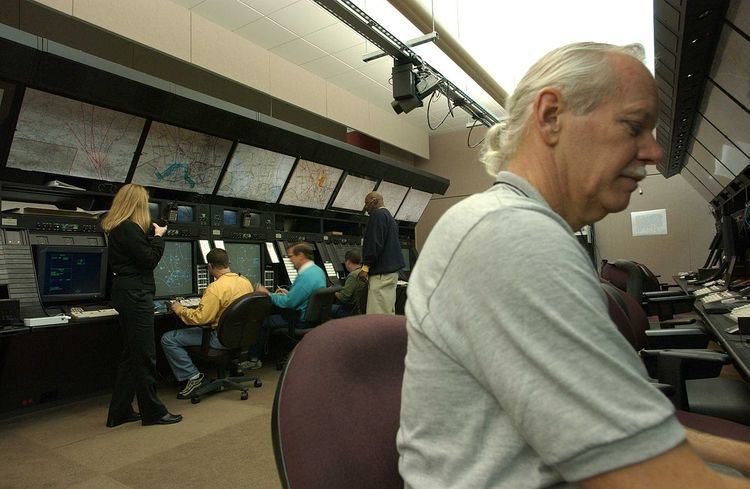
Washington Air Route Traffic Control Center (ZDC) is an Area Control Center located in Leesburg, Virginia, United States. The primary responsibility of ZDC is the separation of airplane flights and the expedited sequencing of arrivals and departures along STARs (Standard Terminal Arrival Routes) and SIDs (Standard Instrument Departures) for the Washington-Baltimore Metropolitan Area, the New York Metropolitan Area, and Philadelphia among many other areas.
Contents
- Basic breakdown of sectors
- Super high sectors
- High sectors
- Intermediate sectors
- Low sectors
- Low Sectors
- High Sectors
- Super High Sectors
- High Altitude Sectors
- Intermediate Sectors
- High Low sectors
- References
Washington Center is the third-busiest air traffic control center in the United States. In 2004–2005, Washington Center was responsible for handling 4,884,000 flights. The Washington ARTCC covers 165,000 square miles (430,000 km2) of airspace that includes airports in Maryland, Pennsylvania, West Virginia, Delaware, New Jersey, Virginia, and North Carolina.
Basic breakdown of sectors
ZDC is divided into eight areas, numbered 1 through 8, that make up 46 sectors. They are mainly broken down into low altitude, intermediate, high altitude and Super High Altitude sectors. There are 18 low sectors, 14 high sectors, five super high sector and four various other type sectors, including 1 high/low altitude sector and three intermediate altitude sectors.
Super high sectors
During periods of traffic saturation in the Shenandoah Sector, ZDC will split the Shenandoah sector into two sectors, making Wahoo a second Super High Sector over the Roanoke and Lynchburg, Virginia areas. Shenandoah normally overlaps the Tech High and Gordonsville High Sectors above FL330. When traffic demand is high, Wahoo is activated to overlap the Gordonsville High Sector above FL330 covering J37 and J75 from GVE VOR south while Shenandoah will overlap Tech High Sector above FL 330 and cover traffic on J48 from CSN VOR south, J22 from MOL VOR south and J53 south of ASBUR intersection near LWB VOR.
High sectors
Intermediate sectors
Low sectors
High sectors
Low sectors
High sectors
Low Sectors
Sector 30 OLD Valley VAL has been changed to NEW 72 Shenandoah SHD Super Hi Sector in Area 1 above. Old Valley Sector merged into Sector 29 Hot Springs.