
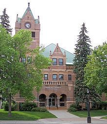
Founded 1857 Population 19,098 (2013) | Website www.co.waseca.mn.us Area 1,122 km² County seat Waseca | |
 | ||
Rivers Le Sueur River, Cobb River, Crane Creek | ||
Waseca County is a county in the U.S. state of Minnesota. As of the 2010 census, the population was 19,136. Its county seat is Waseca.
Contents
- Map of Waseca County MN USA
- Geography
- Lakes
- Major highways
- Adjacent counties
- Demographics
- Cities
- References
Map of Waseca County, MN, USA
Geography
According to the U.S. Census Bureau, the county has an area of 433 square miles (1,120 km2), of which 423 square miles (1,100 km2) is land and 9.6 square miles (25 km2) (2.2%) is water. Waseca is one of seven southern Minnesota counties that have no forest ecosystems, only prairie and savanna soils exist in these counties.
The Le Sueur River flows through part of the county.
Lakes
Major highways
Adjacent counties
Demographics
As of the 2000 census, there were 19,526 people, 7,059 households, and 4,990 families residing in the county. The population density was 46 people per square mile (18/km²). There were 7,427 housing units at an average density of 18 per square mile (7/km²). The racial makeup of the county was 94.65% White, 2.26% Black or African American, 0.59% Native American, 0.46% Asian, 0.03% Pacific Islander, 1.29% from other races, and 0.71% from two or more races. 2.90% of the population were Hispanic or Latino of any race. 47.6% were of German, 15.5% Norwegian, 7.4% Irish and 5.5% American ancestry.
There were 7,059 households out of which 34.70% had children under the age of 18 living with them, 59.00% were married couples living together, 7.80% had a female householder with no husband present, and 29.30% were non-families. 25.10% of all households were made up of individuals and 10.70% had someone living alone who was 65 years of age or older. The average household size was 2.56 and the average family size was 3.07.
In the county, the population was spread out with 25.80% under the age of 18, 8.70% from 18 to 24, 30.00% from 25 to 44, 21.30% from 45 to 64, and 14.20% who were 65 years of age or older. The median age was 36 years. For every 100 females there were 109.30 males. For every 100 females age 18 and over, there were 111.30 males.
The median income for a household in the county was $42,440, and the median income for a family was $50,081. Males had a median income of $34,380 versus $22,630 for females. The per capita income for the county was $18,631. About 4.50% of families and 6.50% of the population were below the poverty line, including 8.80% of those under age 18 and 5.80% of those age 65 or over.