
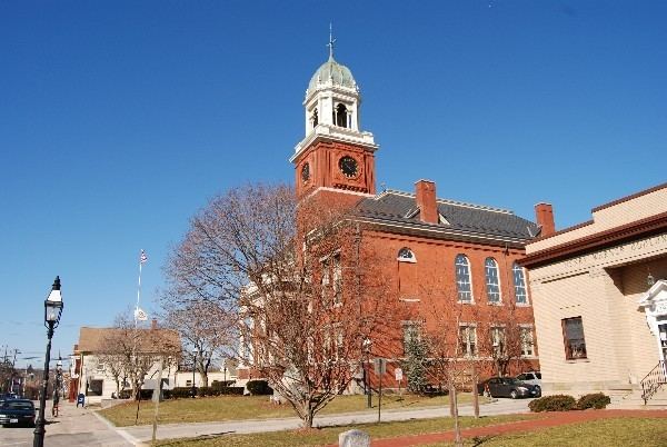
Country United States County Kent Incorporated (city) 1931 ZIP code 02886, 02888, 02889 | State Rhode Island Incorporated (town) 1642 Elevation 36 ft (11 m) Mayor Scott Avedisian (R) | |
 | ||
Weather 9°C, Wind NW at 10 km/h, 38% Humidity Colleges and Universities | ||
Crowne plaza providence warwick airport warwick rhode island
Warwick (locally /ˈwɔːrwɪk/) is a city in Kent County, Rhode Island, United States. It is the second largest city in the state, with a population of 82,672 at the 2010 census. The city of Warwick and T.F. Green Airport are located approximately 12 miles (19 km) south of downtown Providence, 63 miles (101 km) southwest of Boston, Massachusetts, and 171 miles (275 km) northeast of New York City. Its mayor has been Scott Avedisian since 2000.
Contents
- Crowne plaza providence warwick airport warwick rhode island
- Map of Warwick RI USA
- Visit warwick rhode island
- Early history
- Transportation
- Geography
- Demographics
- Economy
- Notable people
- Education
- References
Map of Warwick, RI, USA
Warwick was founded by Samuel Gorton in 1642 and has witnessed major events in American history. It was decimated during King Philip's War (1675–76) and was the site of the Gaspee Affair, a significant prelude to the American Revolution. Warwick is also the home of revolutionary war general Nathanael Greene, George Washington's second-in-command, and Civil War General George S. Greene, hero of the battle of Gettysburg.
Warwick is home to Rhode Island's main airport T. F. Green Airport, which serves the Providence area and also functions as a reliever for Logan International Airport in Boston, Massachusetts. It is also the home of the 43rd Military Police Brigade of the Rhode Island Army National Guard.
Visit warwick rhode island
Early history
Warwick was founded in 1642 by Samuel Gorton when Narragansett Indian Chief Sachem Miantonomi agreed to accept 144 fathoms of Wampum for what was known as "The Shawhomett Purchase". This included the present day towns of Coventry and West Warwick. However, the purchase was not without dispute. The two sachems of the area, Sacononoco and Pumham, stated that Miantonomi had sold the land without asking for their approval. They took their case to Boston, where they placed their lands under Massachusetts rule. In 1643, Massachusetts Bay Colony sent a militia force to Shawomett to arrest Gorton and his followers. After a tense standoff, all but three of the Gortonists surrendered to the Massachusetts force. This event caused the other three settlements on Narragansett Bay (Providence, Portsmouth, and Newport) to unite and get a royal charter allowing them to form the Colony of Rhode Island and Providence Plantations.
In 1648, Gorton was granted a Charter by Robert Rich, 2nd Earl of Warwick, Lord Admiral and head of the Parliamentary Commission on Plantation Affairs. Because of this, the name of the settlement was changed from Shawhomett to Warwick. Massachusetts continued to lay claim to the area, but it made no further effort to enforce it.
In 1772, Warwick was the scene of the first violent act against the Crown in what came to be called the Gaspee Affair. Local patriots mooned and then boarded the Gaspee, a revenue cutter charged with enforcing the Stamp Act 1765 and Townshend Acts in Narragansett Bay where smuggling was common. It was here that the first blood was spilled in the American Revolution when Gaspee's commanding officer Lt. Dudingston was shot in his crotch while resisting the taking of his ship. The Gaspee was stripped of all cannon and arms before being torched.
During the Revolution, Warwick militiamen participated in the battles of Montreal, Quebec, Saratoga, Monmouth, and Trenton, and were present for the surrender at Yorktown.
Transportation
T. F. Green Airport is a station on the Providence/Stoughton Commuter Rail Line, providing weekday service to Providence Station and Boston's South Station.
Geography
Warwick is located at 41°43′N 71°25′W (41.7181, -71.4152).
According to the United States Census Bureau, the city has a total area of 49.6 square miles (128 km2), of which, 35.5 square miles (92 km2) of it is land and 14.1 square miles (37 km2) of it (28.46%) is water.
The following villages are located in Warwick:
Demographics
Warwick is officially a part of the Providence metropolitan area, which has a population of 1,600,852 in 2010 census. As of the census of 2000, there were 85,808 people, 35,517 households, and 22,979 families residing in the city. The population density was 2,417.2 people per square mile (933.3/km²). There were 37,085 housing units at an average density of 1,044.7 per square mile (403.3/km²). The racial makeup of the city was 95.21% White, 1.16% African American, 0.25% Native American, 1.49% Asian, 0.02% Pacific Islander, 0.59% from other races, and 1.28% from two or more races. Hispanic or Latino of any race were 1.60% of the population.
There were 35,517 households out of which 27.4% had children under the age of 18 living with them, 50.7% were married couples living together, 10.2% had a female householder with no husband present, and 35.3% were non-families. 29.8% of all households were made up of individuals and 13.2% had someone living alone who was 65 years of age or older. The average household size was 2.39 and the average family size was 2.99.
In the city, the population was spread out with 21.9% under the age of 18, 6.7% from 18 to 24, 30.1% from 25 to 44, 24.3% from 45 to 64, and 17.0% who were 65 years of age or older. The median age was 40 years. For every 100 females there were 90.8 males. For every 100 females age 18 and over, there were 87.2 males.
The median income for a household in the city was $46,483, and the median income for a family was $56,225. Males had a median income of $39,455 versus $28,946 for females. The per capita income for the city was $23,410. About 4.2% of families and 5.9% of the population were below the poverty line, including 6.4% of those under age 18 and 7.5% of those age 65 or over.
Economy
Before its dissolution, Eckerd Corporation had its headquarters in Warwick.
The ten largest employers in Warwick are Kent Memorial Hospital, Citizens Bank- Warwick Call Center, UPS, MetLife, City of Warwick, Leviton Manufacturing, Wal-Mart, Community College of Rhode Island, J.C. Penney, Kenney Manufacturing, and Inskip Automall.
Notable people
Education
Local public schools are operated by Warwick Public Schools. Toll Gate High School and Pilgrim High School are the two comprehensive public high schools located in Warwick. The two public middle schools are Winman Junior High School and Warwick Veterans Junior High School. Aldrich Junior High School and Gorton Junior High School have recently closed as part of the school consolidation project. Warwick Public Schools are headed by superintendent Phillip Thorton.
Bishop Hendricken High School is an all-male college preparatory Catholic high school located in Warwick. Rocky Hill School is a P-12 coed secular country day school located on Warwick's isolated Potowomut peninsula. The school lists an East Greenwich address, despite being geographically included as part of the city of Warwick.
The Community College of Rhode Island Knight Campus is also located in Warwick on the former Knight Estate.