
Postcode(s) 5650 Postal code 5650 | Time zone ACST (UTC+9:30) Mean max temp Mean min temp Local time Sunday 7:01 AM Population 248 (2006 census) | |
 | ||
Location 334 km (208 mi) NW of Adelaide26 km (16 mi) SE of Wudinna189 km (117 mi) NW of Port Lincoln Weather 13°C, Wind S at 19 km/h, 68% Humidity | ||
Warramboo (wɔrˑræmˑbʉː) is a locality in the Australian state of South Australia located on the Eyre Peninsula about 334 kilometres (208 mi) north-west of the state capital of Adelaide and about 26 kilometres (16 mi) south-east of the municipal seat of Wudinna. It is also located 189 kilometres (117 mi) north of Port Lincoln on the Tod Highway and Port Lincoln-Thevenard branch of the Eyre Peninsula Railway.
Contents
Map of Warramboo SA 5650, Australia
The railway line was constructed from 1907-1915 C.E. to facilitate the development of the cereal industry on the Peninsula. The grain silos remain a distinctive local landmark of the town today. At the 2006 census, Warramboo and the surrounding area had a population of 248.
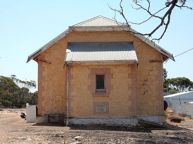
Warramboo is located within the Wudinna District Council. A public school was constructed at Warramboo during early European settlement and remained a source of education for children of 5–12 years old from 1920 until its closure in 2002. The town hall was also constructed in the 1920s. The original wood and iron hall was demolished and a new stone hall constructed in its place in 1934.
The township of Warramboo has little in the way of services, with no shops or petrol stations. The local post office [Post Code; 5650] still services the local community.
The agricultural economy of the region may expand to include iron ore mining in the near future, pending the development of Iron Road Ltd's Central Eyre Iron Project. The deposit is located between Warramboo and Lock, to the east of the Tod Highway.
The local Australian rules football team (Central Eyre Football Club) was formed from an amalgamation of the Warramboo and Kyancutta Football Clubs in 1986. The Central Eyre Football Club is one of 6 teams in the Mid West Football League.
The traditional inhabitants of the Warramboo district and much of the South-West region of Eyre Peninsula are the Nawu/Nauo people. The word 'warramboo' means 'a lake/place of water', referring to the prevalence of samphire swamps in the region.
Mining
The Australian newspaper of 10 March 2014, pg 23, reports a new iron ore (Magnetite) proposal on the Eyre Peninsular. The mine is north of Lock, near Warramboo, with a new deep water port at Hardy Bay. The company concerned is Iron Road Limited. The mine is expected to have a 25-year life, at 20MTPA.
The rail haulage is 150 km, albeit by a somewhat roundabout route.
If is suggested that the line would be 1435mm gauge, so that it can form part of the national SG network.