
Local time Saturday 9:45 PM | ||
 | ||
Weather 13°C, Wind SE at 11 km/h, 65% Humidity | ||
Warmley is a village in South Gloucestershire, England.
Contents
Map of Warmley, Bristol, UK
Warmley is situated in between Bristol and Bath. It is a parish, with its own church, and has some minor landmarks, such as a war memorial site, and a statue of Neptune. It has a main lane, the High Street, having a Tesco's and a Post Office, as well as a barber's, and bicycle shops.
The War Memorial is a 1914 memorial site, used for a meetup on the 11th of November. It has many names carved onto the stone structure, of fallen soldiers.
Transport
The A420 road runs through the village and connects with the Avon Ring Road immediately west of the village. Beyond Warmley the road routes west towards Bristol and east towards Chippenham.
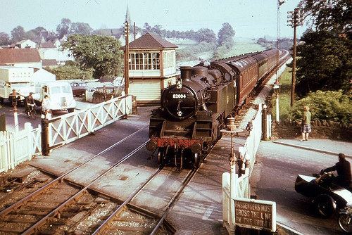
The Midland Railway's line from Bristol as part of the Mangotsfield and Bath Branch Line used to run through the village but closed in the 1960s. The National Cycle Network Bristol & Bath Railway Path runs along the trackbed of the old railway. The old railway station is now a cafe and opposite stands the signalbox which is open most weekends.
The village is served by 6 bus routes, 3 of which run to Bristol City Centre. In numerical order: