
Area 18.65 km (7.20 sq mi) OS grid reference TF 945 417 Local time Monday 3:33 AM | Population 193 (2011) Civil parish Warham | |
 | ||
Weather 9°C, Wind W at 24 km/h, 81% Humidity | ||
Warham is a village and civil parish in the English county of Norfolk. It is situated about 5 km (3.1 mi) inland from the north Norfolk coast, 5 km (3.1 mi) south-east of the town of Wells-next-the-Sea and 50 km (31 mi) north-west of the city of Norwich.
Map of Warham, UK
The civil parish has an area of 18.65 km2 (7.20 sq mi) and in the 2001 census and the 2011 Census had a population of 193 in 79 households. For the purposes of local government, the parish falls within the district of North Norfolk.
Surprisingly, this small village has two large medieval churches, All Saints near the village centre and St Mary Magdalen about 500 m (550 yd) away. Originally, there were two ecclesiastical parishes here, but the two parishes were merged after the Reformation.
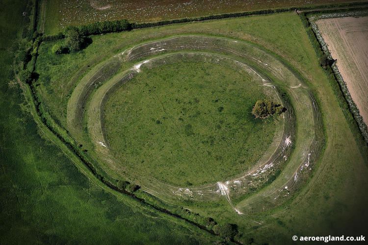
Just south of the village is Warham Camp, a small ancient hill fort earthwork built by the Iceni in the 2nd century BC, known locally as 'the Danish Camp'.
The village has a tiny request stop - Warham railway station - on the narrow gauge Wells and Walsingham Light Railway.