
Postcode(s) 4575 Area 4.5 km² | Warana Coral Sea Postal code 4575 Parish Bribie Island Population 3,512 (2011 census) | |
 | ||
Location 11 km (7 mi) N of Caloundra; 10 km (6 mi) SE of Maroochydore | ||
Warana is a suburb of the Sunshine Coast, Queensland, Australia, located within the Kawana Waters urban centre. At the 2011 Australian Census the suburb recorded a population of 3,512.
Map of Warana QLD 4575, Australia
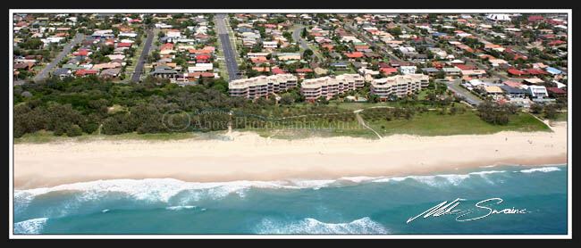
The western boundary of Warana follows the Mooloolah River and the middle of Wyuna Canal. A reserve, which extends southwards into Bokarina and Wurtulla, has been established along the foreshore resulting in the absence of any beachfront development.
References
Warana, Queensland Wikipedia(Text) CC BY-SA