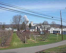
Country United States County Luzerne Elevation 165 m Local time Sunday 6:14 PM | State Pennsylvania Time zone Eastern (EST) Zip code 18660 Area code 379 (570 Exchange) | |
 | ||
Weather 21°C, Wind S at 11 km/h, 20% Humidity | ||
Wapwallopen is an unincorporated community in lower Luzerne County, Pennsylvania. It is designated a "populated community place" (class code U6), a populated place that is not a census designated or incorporated place having an official federally recognized name. It get its name from a Native American settlement that was established where Big Wapwallopen Creek feeds into the Susquehanna River. The Great Indian Warpath historically passed through the area.
Map of Wapwallopen, PA 18660, USA
References
Wapwallopen, Pennsylvania Wikipedia(Text) CC BY-SA
