
 | ||
Similar | ||
Wapta icefields ski mountaineering
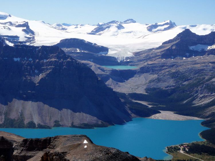
The Wapta Icefield is located on the Continental Divide in the Waputik Mountains of the Canadian Rockies, in the provinces of British Columbia and Alberta. The icefield is shared by Banff and Yoho National Parks and numerous outlet glaciers extend from the icefield, including the Vulture, Bow and Peyto Glaciers. Runoff from the icefields and outlet glaciers supply water to both the Kicking Horse and Bow Rivers, as well as numerous streams and lakes.
Contents
- Wapta icefields ski mountaineering
- Map of Wapta Icefield Improvement District No 9 AB Canada
- Mount gordon wapta icefield summit
- Glaciers
- Huts
- References
Map of Wapta Icefield, Improvement District No. 9, AB, Canada
The icefield is one of the most studied in the Canadian Rockies and all evidence supports the conclusion that the icefield is shrinking in area, especially near the lowest altitudes of its outlet glaciers, including Peyto Glacier, in which the glacier has become both shorter in length and thinner in thickness. In the 1980s the icefield covered an area of approximately 80 km² (30 miles²).
The icefield is easily accessible by mountaineers in both the summer and winter. Both ski trips in the winter and glacier hiking trips in the summer often combine a traverse of this icefield with a trip across the Waputik Icefield directly to the south.
Mount gordon wapta icefield summit
Glaciers
These are the glaciers that are part of this icefield:
Huts
There are 5 huts which provide accommodation to mountaineers on the Wapta Icefield that are operated by the Alpine Club of Canada.