
Opening date 1963 Opened 1963 Construction cost 93.28 million USD | Construction began 1959 Height 56 m Length 2,536 m Turbines 10 x 104 MW Kaplan-type | |
 | ||
Similar Priest Rapids Dam, Rock Island Dam, Wells Dam, Rocky Reach Dam, Ginkgo Petrified Forest St | ||
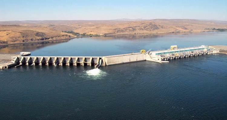
Wanapum Dam is a hydroelectric project located on the Columbia River downstream (south) from Vantage, Washington where Interstate 90 crosses the Columbia from Grant County into Kittitas County. It is owned by the Grant County Public Utility District. Its reservoir is named Lake Wanapum.
Contents
Map of Wanapum Dam, Beverly, WA 99321, USA
The dam, and its lake, are named after the Wanapum Indians. The dam has a rated capacity of 1,040 megawatts and annually generates over 4 million megawatt-hours.
HistoryEdit
The Wanapum dam was originally licensed in 1955 for a period of 50 years. Construction was initiated in 1959 with initial beneficial operation in 1963. The initial license expired in 2005, after which the Grant County PUD operated the dam on yearly license extensions while negotiations for license extension proceeded. The Federal Energy Regulatory Commission approved a license extension of 44 years for both the Wanapum dam and the downstream Priest Rapids dam on April 17, 2008. The license extension was conditioned upon programs to achieve the following goals:
Spillway crackEdit
On February 27, 2014, a 2-inch (5 cm) wide crack was discovered by inspection divers on one of the 65 feet (20 m) tall concrete monoliths that make up the spillway of the dam. A spokesman for the Grant County PUD indicated that the level of the water was to be lowered by 26 feet (8 m) over a period of days to "reduce the pressure on the spillway while inspectors investigate".
According to Washington State Parks, Wanapum State Park will be closed until further notice Effective Monday, April 28, 2014, due to the fracture in the structure of Wanapum Dam. "Grant County Public Utility District has closed all beaches and water access in the area above the dam, which includes Wanapum State Park, to protect sensitive cultural resources and help to ensure public safety. Because water access is integral to the park and a primary focus for visitors, all access to Wanapum State Park will be closed until further notice.
Ginkgo Petrified Forest Interpretive Center, part of the Wanapum area, remains open for day use.
After an 11-week inspection, the primary reason for the crack was determined to be a mathematical error during the pre-construction design of the dam. Repairs of the cracked monolith and the strengthening of the remaining monoliths were made in 2014-2015. The $61 million fix, used steel cabling and rods to stitch the dam to the bedrock underneath.