
Country United States Area code(s) 336 Elevation 280 m Population 3,067 (2013) | Time zone Eastern (EST) (UTC-5) FIPS code 37-70740 ZIP codes 27107, 27265, 27284 Local time Friday 7:04 PM | |
 | ||
Weather 12°C, Wind NW at 21 km/h, 33% Humidity | ||
Wallburg is a town in Davidson County, North Carolina, United States. It was incorporated in 2004. As of the 2013 census it had a population of 3,067.
Contents
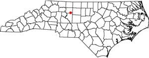
Map of Wallburg, NC, USA
Geography
Wallburg is located in northeastern Davidson County at 36°0′36″N 80°8′22″W. It is bordered to the north by Forsyth County. The town is largely along North Carolina Highway 109, about 10 miles (16 km) southeast of Winston-Salem and the same distance northwest of High Point, between the intersections with Gumtree Road and Shady Grove Church Road, at an elevation of 920 feet (280 m) above sea level. Other nearby municipalities include Kernersville to the northeast, Thomasville to the south, and Midway to the southwest. Wallburg is located in the Wallburg Elementary, Oak Grove Middle School, and Ledford Senior High school districts. In 2017, the Wallburg high school district will be changed to the Oak Grove High School district, which will be located across the street from Oak Grove Middle School.
According to the United States Census Bureau, the town has a total area of 5.6 square miles (14.4 km2). None of the area is covered with water.
History
The George W. Wall House was added to the National Register of Historic Places in 1984.