
District Bad Kreuznach Elevation 195 m (640 ft) Population 2,346 (31 Dec 2008) Postal code 55596 | Time zone CET/CEST (UTC+1/+2) Local time Friday 7:22 AM | |
 | ||
Weather 3°C, Wind W at 6 km/h, 87% Humidity | ||
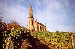
Waldböckelheim is a municipality in the district of Bad Kreuznach in Rhineland-Palatinate, in western Germany.
Contents
Map of Waldb%C3%B6ckelheim, Germany
Geography
Waldböckelheim is located north of the Nahe in the Rhenish Massif. Waldböckelheim is surrounded by three extinct volcanoes.
History
It was mentioned first on 10 February 824 Becchilenheim. The prefix Wald (forest) was prefixed in the 13th Century to distinguish themselves from Gau-Bickelheim. In the castle Böckelheim was Emperor Henry IV prisoner of his son in December 1105. The office Bockelheim was formed together with the surrounding villages. After changing ownership several times, it belonged more than 300 years to the Electorate of the Palatinate.
Economy
In Waldböckelheim there are two kindergartens, one primary, a Regionale Schule and a voluntary fire brigade.