
OS grid reference TQ325810 Source Finsbury Sovereign state United Kingdom | Postcode district EC4 Dialling code 020 | |
 | ||
Similar London Mithraeum, Walbrook Wharf, River Tyburn, St John the Baptist upon Wal, All‑Hallows‑the‑Less | ||
Lost river walbrook
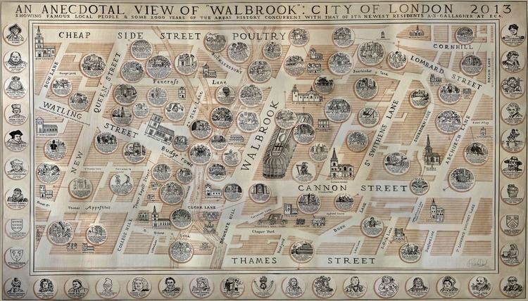
Walbrook is a subterranean river in the City of London that gave its name to a City ward and a minor street in its vicinity.
Contents
- Lost river walbrook
- The ancient world in london londinium basilica forum walbrook temple of mithras and guildhall
- The river
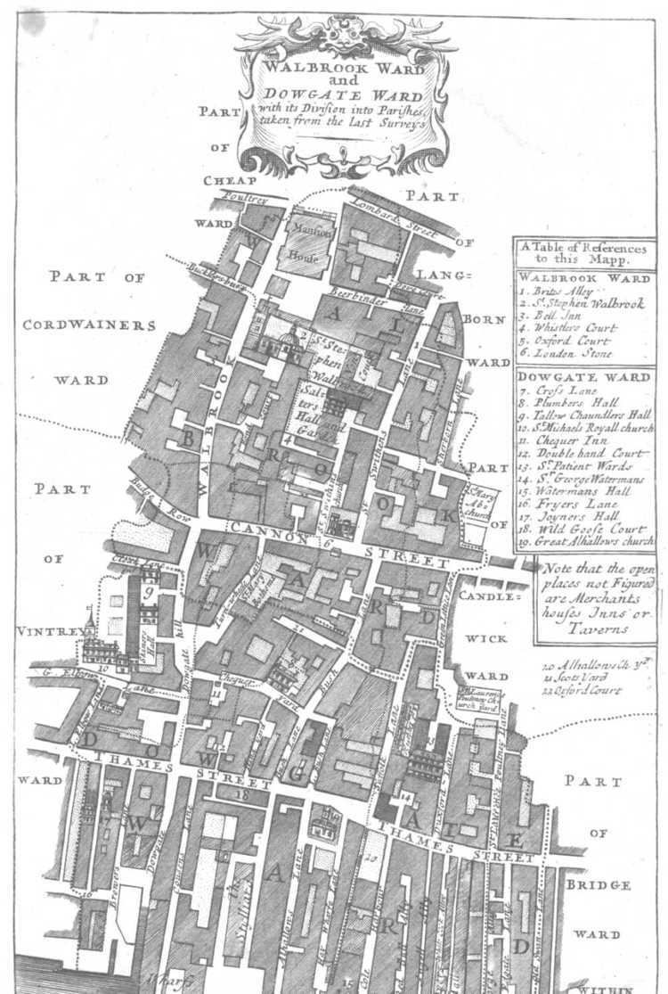
- The ward
- References
The ward of Walbrook contains two of the City's most notable landmarks: the Bank of England and Mansion House. The street runs between Cannon Street and Bank junction, though vehicular traffic can only access it via Bucklersbury, a nearby side-road off Queen Victoria Street.
The ancient world in london londinium basilica forum walbrook temple of mithras and guildhall
The river
The brook played a very important role in the Roman settlement of Londinium, the city now known as London. The stream started in what is now Finsbury and flowed through the centre of the walled city, bringing a supply of fresh water whilst carrying waste away to the River Thames. Effectively dividing the settlement in two, it emerged just to the west of the present-day Cannon Street Railway Bridge. During Roman times it was also used for transport, with the limit of navigation some 200m from the Thames, at a point now known as Bucklersbury building. It was there the Romans built a port and temple to Mithras on the east bank of the stream. The temple was found and later excavated during rebuilding work after World War II. The Roman Governor's palace was found further down the east bank of the stream, near its entry into the Thames. The etymology begins soon after Londinium was captured by the invading Anglo-Saxons during the late 6th century (also known then as Caer Lundein). It is thought that the brook was named because it ran through or under the London Wall; another theory is the name comes from Weala broc meaning 'brook of the Welsh'. Walbrook formed one division in the city: Ludgate Hill to the west and Cornhill to the east.
When St. Margaret Lothbury was rebuilt in 1440, the Lord Mayor Robert Large paid for the lower Walbrook to be covered over. By the time of the first maps of the area, the "copperplate" map of the 1550s and the derivative "Woodcut" map of c.1561, the whole Walbrook within the city walls was culverted. John Stow, the historian of London, wrote about the Walbrook in 1598, saying that the watercourse, having several bridges, was afterwards vaulted over with brick and paved level with the streets and lanes where it passed and that houses had been built so that the stream was hidden as it is now.
The Walbrook's source was Moorfields, north of the City wall which it passed through just west of All Hallows-on-the-Wall Church.
In the 1860s, excavations by General Augustus Pitt Rivers uncovered a large number of human skulls, and almost no other bones, in the bed of the Walbrook. This has been seen as reminiscent of a passage from Geoffrey of Monmouth's History of the Kings of Britain (ca. 1136) in which a legion of Roman soldiers who surrendered to Asclepiodotus after being besieged in London were decapitated by his allies the Venedoti, and their heads thrown into a river called the Gallobroc. However, Geoffrey's History is notoriously unreliable, and some historians consider these skulls to be a result of the rebellion of Boudica. As late as the early 19th century, part of the branch that runs from Islington was open and powered a lead mill.
The construction of the massive infrastructure of the London sewerage system with five main sewers incorporated many existing culverts, storm sewers, or sluices. This included the culvertized Walbrook, which by 1860 had been linked into a network of 82 miles worth of new sewerage lines, channeled to the Northern Low Level Sewer at a point near the Bank of England. Many small leaks stream into the rounded sewer for much of the year when the water table is sufficient.
On 18 June 1999, during the "Carnival Against Capitalism", timed to coincide with the 25th G8 summit, fire hydrants were opened along the route of the Walbrook by Reclaim the Streets, symbolically releasing the river to "reclaim the street" from the "capitalist forces" of city growth which had subsumed it.
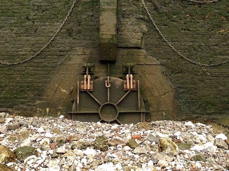
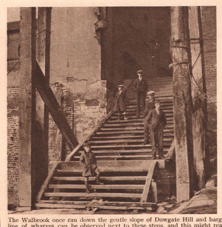
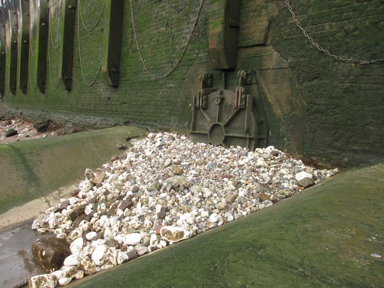
The Walbrook is one of many "lost" rivers of London, the most famous of which is the River Fleet. It entered the Thames at Dowgate.
The ward
The river's only evidence above ground is the lower-end street called Walbrook, running parallel and a barely discernible dip in the land forming its catchment. On the street is a church called St Stephen Walbrook, which originally stood on the west bank of the stream, but was rebuilt around 1439 on the east side. In 1666 the church was destroyed in the Great Fire of London and Sir Christopher Wren built a new church there in 1672 to replace it, which still stands. The historic London Stone is situated on Cannon Street within the ward of Walbrook. The Bank of England and Mansion House, the official residence of the Lord Mayor, are both situated in Walbrook ward. Within the ward is also The Walbrook Club, a private dining club founded in 2000. It was designed by the late Mark Birley of Annabel's and is set in a Queen Anne-style townhouse.
Walbrook is one of 25 wards in the City of London, each electing an Alderman, to the Court of Aldermen and Commoners (the City equivalent of a Councillor) to the Court of Common Council of the City of London Corporation. Only electors who are Freemen of the City of London are eligible to stand.