
Country New Zealand | ||
 | ||
The Waipori River is in Otago in the South Island of New Zealand. Rising in the Lammerlaw Range, it flows southeast for 50 kilometres (31 mi) before joining the Taieri River near Henley, 30 kilometres (19 mi) southwest of Dunedin of which it is officially the southernmost border.
Map of Waipori River, Otago, New Zealand
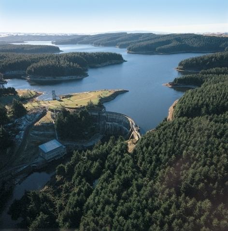
The upper reaches of the Waipori flow through rough hill country, much of it covered by the Berwick Forest. An artificial lake, Lake Mahinerangi is formed on the river behind a small hydroelectric station at Waipori Falls, which was built in 1880 to provide power for the city of Dunedin. Much of this area is within the Waipori Falls Scenic Reserve.
The lower reaches of the river pass through an area of wetlands around Lakes Waihola and Waipori, both of which drain into the river. This area is a habitat for many species of wading birds. The Sinclair Wetlands reserve is located in this area.
The name Waipori comes from Maori words meaning "dark water".