
Local time Friday 6:47 AM | ||
 | ||
Weather 8°C, Wind NW at 10 km/h, 89% Humidity | ||
Henley is a township on New Zealand's Taieri Plains, presumably named after the rowing centre Henley-on-Thames in England. It lies close to the confluence of the Taieri and Waipori Rivers at the eastern edge of the plain, at the foot of a low range of coastal hills.
Map of Henley, New Zealand
Henley is near the south-west extremity of the City of Dunedin, 35 km from the city centre, and close to Lake Waihola, one of the country's rowing centres. Henley's population is about 250.
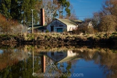
The main industry is dairy farming. Henley used to have a cheese factory which later moved to the nearby township of Momona. This was later bought out by the company that became Mainland Cheese.
The original Māori name for Henley is Maitapapa. The churches in Henley are Presbyterian and Brethren.
Henley township is prone to flooding by the Taieri River. State Highway 1 is built on top of the bank that divides the larger Henley area. In June 1980 the South Taieri region experienced severe floods that flooded both sides of the highway and extended as far as Dunedin Airport.Contributing factors to this were already full wetlands at Lake Waihola with the Taieri and Waipori Rivers both draining into this area. Excessive water from the Lake Mahinerangi dam was also released at this time. This placed significant pressure on the banks causing a breach.