
Territorial authority Local time Friday 8:53 AM | Region Canterbury Postcode 7420 | |
 | ||
Weather 9°C, Wind SW at 13 km/h, 72% Humidity | ||
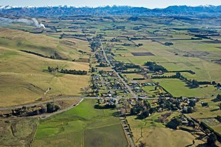
Waikari (Maori name 'Muddy Waters') is a small town in the Canterbury region of New Zealand's South Island.
Contents
Map of Waikari, New Zealand
Its Anglican parish church is the Church of Ascension, 79 Princes Street, Waikari, where William Orange was vicar in the 1920s.
Waikari is located on State Highway 7 near the Weka Pass and was served by the Waiau Branch railway from 6 April 1882 until its closure on 15 January 1978. The section of the railway through the Weka Pass has been retained by the Weka Pass Railway and preserved trains operate between Waipara and Waikari.
The town is also located near the site of Māori cave art and rock drawings in the Weka Pass Reserve.
Notable people
References
Waikari Wikipedia(Text) CC BY-SA