
District Hurunui District Area 8,646 km² | Region Canterbury Formed 1989 Time zone NZST (UTC+12) | |
 | ||
Points of interest Mount Lyford, Hanmer Springs Ski Area, Thrillseekers Adventures, Waipara Hills, Waipara Springs Wines Destinations | ||
The Hurunui District is a political district on the east coast of New Zealand's South Island, north of Christchurch, New Zealand. It forms part of the Canterbury region and stretches from the east coast to the main divide. Its land area is 8,660.43 square kilometres (3,343.81 sq mi).
Contents
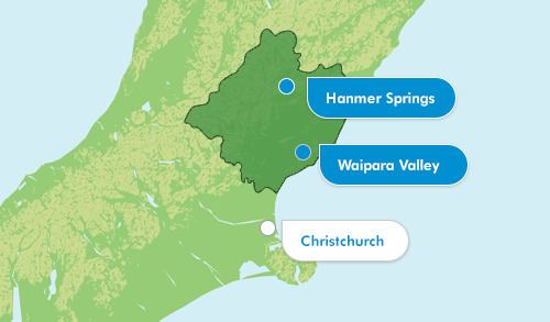
Map of Hurunui District, Canterbury, New Zealand
Population
The district had a usually resident population of 12,700 as of June 2016. It also shares with the Waitaki District with the distinction of having the least number of non-European populations anywhere in New Zealand in both raw numbers and proportion, with over 95% of population recorded in the 2006 census as "European" or "New Zealanders" (which could be interpreted as mostly European according to antedocal evidence). Local populations could even recognise the identities of every local Maori or Asian recorded in the census.
Local government
During the period, 1853 to 1876, the area north of the Hurunui River was administrated as part of the Nelson Province. After the abolition of the provinces in 1876 the Amuri and Cheviot counties were formed. In 1989, these counties were merged with the Ashley and Waipara counties to form the present district. The current district mayor is Winton Dalley, who was elected in 2010 upon the retirement of previous mayor Gary Jackson and reelected in the 2013 local government election after running unopposed.