
Floor elevation 4,577 feet (1,395 m) | ||
 | ||
Wah wah valley beaver county low point utah
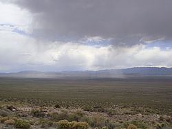
Wah Wah Valley is an endorheic (internal drainage) valley within the Basin and Range of west-central Utah. It is bound by the Wah Wah Mountains to the west and south and the San Francisco Mountains to the east. The northern part of the valley bifurcates around the southern end of the House Range, leading into Tule Valley to the northwest and the Sevier Desert-(Sevier Lake region), to the northeast.
Contents
The 'Wah Wah' name comes from Wah Wah Springs, on the eastern slope of the Wah Wah Mountain range. 'Wah Wah' is reported to mean "good clear water".
The lowest point in Beaver County is located just south of the Wah Wah Hardpan (dry lake), at the Millard County line.
The valley is sparsely populated today, but it has had residents in the past, like in the ghost town of Newhouse. These people moved here for mining, but later, the region was used for grazing.