
Admin. region Karlsruhe Elevation 104 m (341 ft) Area 42.84 km² Local time Thursday 9:11 PM | District Karlsruhe Time zone CET/CEST (UTC+1/+2) Population 20,548 (31 Dec 2008) | |
 | ||
Weather 9°C, Wind W at 5 km/h, 54% Humidity | ||
Waghäusel ( [ˈvak.hɔʏzəl], [ˈvak.hɔusɛl]) is a German town located in the Rhine valley in the south-western state of Baden-Württemberg. Waghäusel consists of 3 townships which are the core city (1236 residents), Kirrlach (9347 residents), and Wiesental (9596 residents) [as of March 31, 2006]. Wiesental and Kirrlach are located on Bertha Benz Memorial Route.
Contents
Map of 68753 Wagh%C3%A4usel, Germany
Among the 3 townships, Wiesental occupies the largest land area of 21.2 km² followed by Kirrlach with 19.4 km² and the core city with 0.22 km².
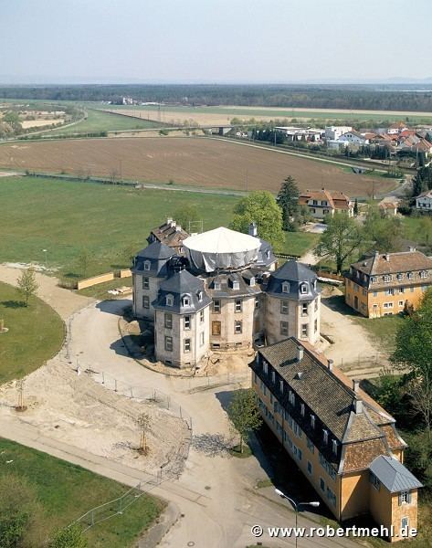
Sights
International relations
Waghäusel is twinned with the following towns:
References
Waghäusel Wikipedia(Text) CC BY-SA