
Country Albania Time zone CET (UTC+1) Vehicle registration AL Elevation 60 m Postal code 1032 | Area Code (0)47 Website Official Website Area 41 km² Local time Wednesday 6:09 AM | |
 | ||
Weather 12°C, Wind S at 0 km/h, 88% Humidity | ||
Vorë is a municipality in Tirana County, central Albania. It was formed at the 2015 local government reform by the merger of the former municipalities Bërxullë, Prezë and Vorë, that became municipal units. The seat of the municipality is the town Vorë. The total population is 25,511 (2011 census), in a total area of 82.72 km2. The population of the former municipality at the 2011 census was 10,901.
Contents
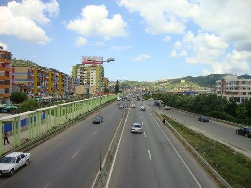
Map of Vor%C3%AB, Albania
Etymology
According to a tradition,the name of Vorë comes from the Albanian word "vorre" (varre) that means "graveyard".According to that tradition, the name comes from the time of Skanderbeg, because there were buried the fallen soldiers at a war.
Description
The town is located on National Road 2, between Tirana and Durrës, to the west of the capital. It is part of the Tirana-Durrës metropolitan region - industrial and commercial facilities extend along the motorway almost all the way from Tirana to Vorë. many people who have moved from the countryside to urban areas have settled in laces like Vorë or Kamëz. However, the migrants prefer places which lie closer to Tirana and, as a result, other satellite settlements have grown much more rapidly in recent years.
Many villages fall within the bounds of the municipality. In 2015, the bashkia of Vorë was merged with Bërxullë which neighboured it to the east and had 9883 inhabitants and with Prezë which was located to the northeast and had 4727 inhabitants. There is a fifteenth century castle in Prezë. The eastern edge of the municipality borders Tirana airport.
Vorë is an important transport hub for Central Albania. It lies in the middle of the long range of hills known as the Kodra e Gjatë which separates the Plain of Tirana from the plains running along the Erzen and surrounding Durrës to the west. Vorë is located in a pass, not more than 60 metres high, which cuts through the Kodra e Gjatë range. Railways, motorways, country roads, overhead power lines are all routed through this pass. Previously there was a canal as well. The roads from Durrës and the railways run by Hekurudha Shqiptare go on from Vorë through Fushë-Krujë to the northern part of the country and onwards to Tirana in the east. Trains from Tirana to Shkodër have to change locomotive at the Vorë station.
Gërdec explosions
The municipality of Vorë includes the small village of Gerdec. In the Albanian Armed Forces' munition store in this settlement, an accident occurred on 15 March 2008, which caused a series of large explosions, lasting for several hours. As a result of these explosions 26 people lost their lives and several hundred were injured. Several hundred houses and two small villages were completely destroyed and 1,500 buildings were damaged.