
Existed: 1940 – present Length 11.81 km | Constructed 1940 | |
 | ||
Counties | ||
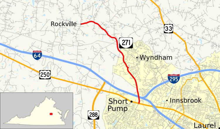
State Route 271 (SR 271) is a primary state highway in the U.S. state of Virginia. Known as Pouncey Tract Road, the state highway runs 7.34 miles (11.81 km) from U.S. Route 250 (US 250) in Short Pump north to SR 620 and SR 622 in Rockville.
Contents
Map of VA-271, Virginia, USA
Route description
SR 271 begins at an intersection with US 250 (Broad Street) in the suburban community of Short Pump in western Henrico County. The south leg of the intersection is Pump Road. The state highway heads north as a four-lane divided highway to the east of Short Pump Town Center and crosses over Interstate 64 (I-64) just west of its western interchange with I-295. SR 271 reduces to two lanes north of the overpass and passes along the western edge of the suburban community of Wyndham. Now you see the Short Pump Middle School Grounds after the intersection with Twin Hickory Lake Drive. The state highway temporarily becomes a four-lane divided highway again by turning left at its perpendicular intersection with Nuckols Road. SR 271 leaves the suburban area as a two-lane road that cuts through the northeastern corner of Goochland County near the headwaters of the Chickahominy River to the east before entering Hanover County. The state highway continues west to its northern terminus at the intersection of SR 620 and SR 622 in the village of Rockville. SR 622 heads south as Rockville Road and north as Walnut Hill Drive; SR 620 heads west as Dogwood Trail Road.