
Existed: 1940s – present Length 2.38 km | ||
 | ||
Counties | ||
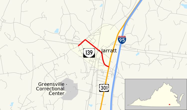
State Route 139 (SR 139) is a primary state highway in the U.S. state of Virginia. Known for most of its length as Jarratt Avenue, the state highway runs 1.48 miles (2.38 km) from SR 610 east to U.S. Route 301 (US 301) and SR 631 within Jarratt. SR 139 connects the town of Jarratt, which has sections in both Greensville County and Sussex County, to US 301 and, via SR 631, Interstate 95 (I-95).
Contents
Map of VA-139, Jarratt, VA 23867, USA
Route description
SR 139 begins at a three-way intersection with SR 610 (Allen Road) and Grigg Avenue in the western part of the town of Jarratt. The state highway heads northeast as two-lane Allen Road, which intersects a railroad spur that serves the adjacent Georgia-Pacific plant. SR 139 turns southeast onto Jarrett Avenue, which passes through a residential area and crosses the rail spur again. Shortly after crossing the Greensville–Sussex county line, the state highway has an at-grade crossing of CSX's North End Subdivision. SR 139 reaches its eastern terminus at a four-way intersection with US 301 (Blue Star Highway) and SR 631 (Henry Road) at the eastern town limit of Jarratt. SR 631, which forms the east leg of the intersection, has a diamond interchange with I-95 east of US 301.