
Country United States FIPS code 19-81210 Elevation 240 m Population 5,181 (2013) Area code 472 (319 Exchange) | State Iowa Time zone Central (CST) (UTC-6) GNIS feature ID 0462580 Zip code 52349 Local time Monday 3:23 PM | |
 | ||
Weather 10°C, Wind N at 13 km/h, 94% Humidity Area 12.51 km² (12.28 km² Land / 23 ha Water) | ||
Vinton is a city in Benton County, Iowa, United States. The population was 5,257 in the 2010 census, an increase from 5,102 in the 2000 census. It is also part of the Cedar Rapids Metropolitan Statistical Area. Vinton is the county seat of Benton County.
Contents
- Map of Vinton IA 52349 USA
- History
- Geography
- Climate
- 2010 census
- 2000 census
- Education
- Notable people
- References
Map of Vinton, IA 52349, USA
History
Vinton was founded in 1849. It was named for Hon. Plynn Vinton, a state legislator. The first railroad line was extended to Vinton in 1869, and it was incorporated as a city that same year.
Geography
Vinton's longitude and latitude coordinates
in decimal form are 42.164144, -92.026077.
According to the United States Census Bureau, the city has a total area of 4.83 square miles (12.51 km2), of which, 4.74 square miles (12.28 km2) is land and 0.09 square miles (0.23 km2) is water.
Vinton is located on U.S. Route 218 and the Cedar River, which has flooded parts of the city, most recently in 2008. The town's extensive tree cover was damaged by a derecho (straight line windstorm) on July 11, 2011.
Climate
This region has significant seasonal temperature differences, going from warm summers to very cold winters. There is precipitation year-round, and snowfall occurs in almost all years. Most summer rainfall occurs during thunderstorms and a very occasional tropical system. Vinton averages 32.7 inches of precipitation annually. May and June are the wettest months; January and February, the driest. This area is classified as humid because it is not dry enough to be classified as semi-arid or arid.
2010 census
As of the census of 2010, there were 5,257 people, 2,187 households, and 1,397 families residing in the city. The population density was 1,109.1 inhabitants per square mile (428.2/km2). There were 2,299 housing units at an average density of 485.0 per square mile (187.3/km2). The racial makeup of the city was 97.8% White, 0.3% African American, 0.2% Native American, 0.3% Asian, 0.2% from other races, and 1.2% from two or more races. Hispanic or Latino of any race were 1.0% of the population.
There were 2,187 households of which 30.4% had children under the age of 18 living with them, 47.9% were married couples living together, 11.3% had a female householder with no husband present, 4.6% had a male householder with no wife present, and 36.1% were non-families. 31.0% of all households were made up of individuals and 16.1% had someone living alone who was 65 years of age or older. The average household size was 2.33 and the average family size was 2.91.
The median age in the city was 40.3 years. 24.7% of residents were under the age of 18; 8.1% were between the ages of 18 and 24; 23.1% were from 25 to 44; 24.5% were from 45 to 64; and 19.5% were 65 years of age or older. The gender makeup of the city was 47.3% male and 52.7% female.
2000 census
As of the census of 2000, there were 5,102 people, 2,116 households, and 1,390 families residing in the city. The population density was 1,187.7 people per square mile (458.1/km²). There were 2,227 housing units at an average density of 518.4 per square mile (200.0/km²). The racial makeup of the city was 98.26% White, 0.25% African American, 0.18% Native American, 0.27% Asian, 0.02% Pacific Islander, 0.22% from other races, and 0.80% from two or more races. Hispanic or Latino of any race were 0.94% of the population.
There were 2,116 households out of which 30.8% had children under the age of 18 living with them, 53.8% were married couples living together, 9.7% had a female householder with no husband present, and 34.3% were non-families. 29.9% of all households were made up of individuals and 15.0% had someone living alone who was 65 years of age or older. The average household size was 2.34 and the average family size was 2.91.
25.0% are under the age of 18, 7.9% from 18 to 24, 27.3% from 25 to 44, 19.5% from 45 to 64, and 20.2% who were 65 years of age or older. The median age was 38 years. For every 100 females there were 90.1 males. For every 100 females age 18 and over, there were 84.6 males.
The median income for a household in the city was $35,114, and the median income for a family was $41,546. Males had a median income of $32,460 versus $19,988 for females. The per capita income for the city was $19,808. About 9.5% of families and 9.8% of the population were below the poverty line, including 13.7% of those under age 18 and 6.0% of those age 65 or over.
Portions of downtown Vinton, along with the Benton County courthouse, were featured in the 1996 John Travolta film Michael. Also seen during the movie's opening credits was Prairie Creek Church, a rural area Christian church located approximately six miles northeast of the city.
Portions of downtown Vinton were used in the movie "The Final Season"
Education
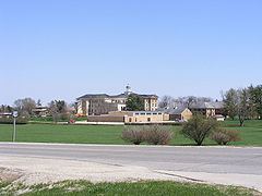
Vinton is the home of the Iowa Braille and Sight Saving School, Iowa's state educational institution for vision-impaired students.
Residing in the Braille School since 2008 is the North Central Region headquarters for AmeriCorps National Civilian Community Corps (NCCC).