
INSEE/Postal code 89464 /89500 Population 5,404 (1999) | Time zone CET (UTC+1) Area 40 km² Local time Monday 5:47 PM | |
 | ||
Region Bourgogne-Franche-Comté Weather 19°C, Wind N at 13 km/h, 42% Humidity | ||
Villeneuve-sur-Yonne is a commune in the Yonne department in Bourgogne-Franche-Comté in north-central France.
Contents
- Map of 89500 Villeneuve sur Yonne France
- Geography
- History
- Demography
- Main sights
- Sister and twin cities
- References
Map of 89500 Villeneuve-sur-Yonne, France
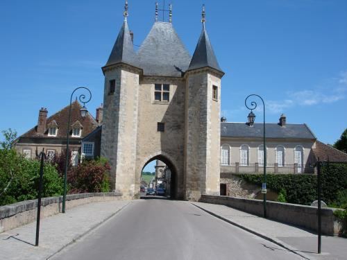
It is surrounded by a partly intact wall, built during the 12th century, which was one of the 8 residences of the French kings.
Geography
The city lies on the bank of the River Yonne, between the cities of Sens and Joigny.
History
The city was founded in 1163 by Louis VII of France to protect the kingdom of France at the boundary of the Champagne. In 1204 King Philip II Augustus held parliament in the city, and Louis IX resided in the city before departing for the Eighth Crusade. In 1594 the city was burnt down. During the French Revolution the name was changed from le-Roi (the king) to sur-Yonne (on the Yonne). In 1870 a memorial for the dead was designed by the sculptor Émile Peynot. The city was governed from 1927 till 1935 by the infamous mayor Marcel Pétiot, who was guillotined in 1946, convicted of 27 killings.
Demography
The inhabitants are called Villeneuviens.