
Total islands 5 Highest elevation 70 m (230 ft) Area 150 ha | Archipelago De Long Islands Width 1 km (0.6 mi) Elevation 70 m Max length 2 km | |
 | ||
Federal subject | ||
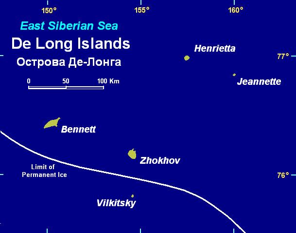
Vilkitsky Island (Russian: Oстров Вильки́цкого; Ostrov Vilkitskogo) is the southernmost island of the De Long group in the northern part of the East Siberian Sea. Administratively Vilkitsky Island belongs to the Sakha Republic administrative division of the Russian Federation.
Contents
Map of Vilkitsky Island, Russia
The island is named after Russian hydrographer Boris Vilkitsky.
Geography
The island is outside of the limits of permanent ice and is unglaciated. At barely 1.5 square kilometres (0.6 square miles) Vilkitsky is the smallest island of the group. The highest elevation is 70 metres (230 feet) above sea level.
Vilkitsky Island consists of deeply eroded nepheline basalt lava flows
History
Vilkitsky Island was discovered in 1913 during the Imperial Russian Arctic Ocean Hydrographic Expedition led by Boris Vilkitsky on the ships Taymyr and Vaygach on behalf of the Russian Hydrographic Service in order to chart the last blank areas of Russian maps.