
Country Brazil Local time Monday 5:51 AM | Area 13,631 km² | |
 | ||
Time zone BRT-1/BRST-1 (UTC-4/-3) Weather 24°C, Wind N at 6 km/h, 96% Humidity | ||
Vila bela da sant ssima trindade 262 anos
Vila Bela da Santíssima Trindade is a Brazilian municipality in Mato Grosso with 14,523 (2009) inhabitants. It is located at upper Guaporé River close to the border with Bolivia. It served as the capital of the Captaincy of Mato Grosso from 1752 to 1820.
Contents
- Vila bela da sant ssima trindade 262 anos
- Map of Vila Bela da SantC3ADssima Trindade State of Mato Grosso Brazil
- References
Map of Vila Bela da Sant%C3%ADssima Trindade - State of Mato Grosso, Brazil
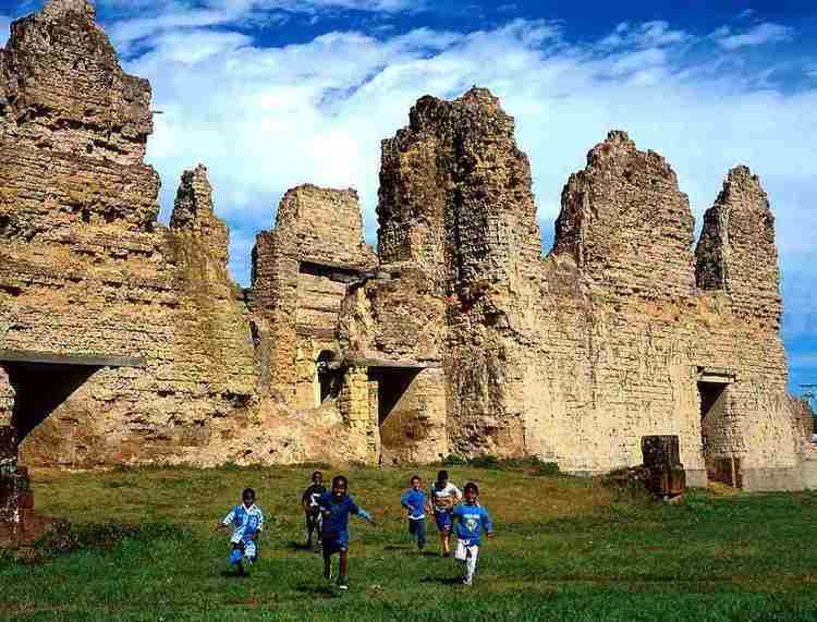
Today, because most inhabitants descend from former African slaves, the town creates the impression of a town in the African jungle rather than in one in the Amazon jungle. The distinct African feeling is also reflected in a yearly festival called Festa do Congo. One of its main events is the Dança do Congo, which is performed at the ruins of the former igreja matriz — a particular type of colonial Portuguese church. Aside from those church ruins, which are the main tourist site of the town, there is a small history museum as well.
The town serves as a hub for trips to the Amazon jungle along the upper Guaporé River and the nearby nature reserve Parque Estadual da Serra de Ricardo Franco. One of the main attractions of the latter is the Cascata dos Namorados (engl. Valentine Cascades). The municipality contains the 158,621 hectares (391,960 acres) Serra Ricardo Franco State Park, created in 1997.