
Basin area 266,460 km² Discharge 1,530 m³/s Source Parecis plateau | Length 1,530 km Source elevation 631 m | |
 | ||
- right Guatire River, Branco River, Corumbiara River, Colorado River, Massaco River, Cabixi River - average 1,530 m/s (54,030 cu ft/s) | ||
Kayak insane guapor river brazil
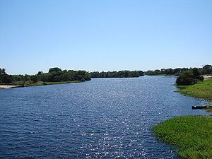
Guaporé River (Portuguese: Rio Guaporé) is a river in western Brazil and northeastern Bolivia. Its Bolivian name is Río Iténez. It is 1,530 km (950 mi) long; 970 km (600 mi) of the river forms the border between Brazil and Bolivia.
Contents
Map of Rio Itenez O Guapore
The Guaporé River is part of the Madeira River basin, which eventually empties into the Amazon River. The Guaporé River crosses the eastern part of the Beni savanna region. It forms the border of the 615,771 hectares (1,521,600 acres) Guaporé Biological Reserve, and is fed by rivers originating in the reserve, the São Miguel, Branco, São Simão, Massaco and Colorado.
About 260 fish species are known from the Guaporé River basin, and about 25 of these are endemic. While many fish species in the river essentially are Amazonian, the fauna in the Guaporé also has a connection with the Paraguay River (part of the Río de la Plata Basin). The Guaporé and the Paraguay, while flowing in different directions, both originate in the Parecis plateau of Brazil. Among the fish species shared between these rivers are the black phantom tetra (important in the aquarium industry) and golden dorado (important in fisheries).