
Other name(s) Occitan: La Vinhana Progression Loire→ Atlantic Ocean Length 363 km Source Plateau de Millevaches Country France | River mouth Loire Discharge 203 m³/s Basin area 21,105 km² Mouth Loire | |
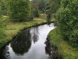 | ||
Main source Plateau de Millevaches
880 m (2,890 ft) Basin size 21,105 km (8,149 sq mi) Bridges place Henri-IV, Pont Saint-Martial, Pont Saint-Étienne, Pont Camille de Hogues, Châtellerault | ||
The Vienne (Occitan: Vinhana) is one of the most important rivers in south-western France. It is a significant left tributary of the lower Loire. It supports numerous hydro-electric dams, and it is the main river of the Limousin region and also of the eastern part of the Poitou-Charentes region.
Contents
Map of Vienne, France
Two French departments are named after the Vienne: Haute-Vienne (87) in the Limousin region and Vienne (86) in the Poitou-Charentes region.
CourseEdit
The Vienne rises as a spring in the department of Corrèze, at the foot of Mont Audouze, on the Plateau de Millevaches, near Peyrelevade. It then flows roughly west to the city of Limoges where it once played a major role in the famous Limoges porcelain industry. A little way after Limoges it takes a turn to the north. En route to its confluence with the Loire, the Vienne is joined by the rivers Creuse and Clain. Finally, after a journey of 372 km it reaches the Loire at Candes-Saint-Martin in the department of Indre-et-Loire.
The Vienne flows through the following departments and towns:
Tributaries include: