
Population 6,989 (2013 est) Region Katherine Region Website Victoria Daly Region Area 168,277 km² Council seat Katherine (outside LGA) Federal division Division of Lingiari | Established 2008 Territory electorate(s) Stuart Victoria Daly Region Roper Gulf Founded 2008 Mayor Betty Sullivan | |
 | ||
Points of interest Umbrawarra Gorge Nature Park Destinations Pine Creek - Northern, Timber Creek - Northern, Keep River National Park, Judbarra / Gregory National, Douglas‑Daly | ||
The Victoria Daly Region is a local government area of the Northern Territory, Australia. The shire covers an area of 168,277 square kilometres (64,972 sq mi) and has an estimated population of 6,000 people.
Contents
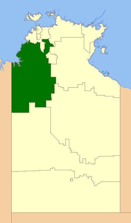
Map of Victoria - Daly, NT, Australia
History
In October 2006 the Northern Territory Government announced the reform of local government areas. The intention of the reform was to improve and expand the delivery of services to towns and communities across the Northern Territory by establishing eleven new shires. The Victoria Daly Shire was created on 1 July 2008 as were the remaining ten shires. The first election for the Shire was held on 25 October 2008.
A general election was held on 24 March 2012. Councillor Betty Sullivan was elected Mayor of Victoria Daly Shire Council.
The Shire became the Victoria Daly Region on 1 January 2014.
Most of the land now part of the Region used to be unincorporated, but several existing LGAs were merged into it:
Wards
The Victoria Daly Regional Council is divided into 5 wards, which is governed by 11 councillors across four wards: