
Area rank 217 in Norway Area 463 km² Local time Sunday 5:57 PM | County Oppland Demonym(s) Vestreslidring Population 2,304 (2004) | |
 | ||
Weather 8°C, Wind W at 14 km/h, 55% Humidity | ||
Vestre Slidre is a municipality in Oppland county, Norway. It is part of the traditional region of Valdres. The administrative centre of the municipality is the village of Slidre. The old municipality of Slidre was divided into Vestre Slidre and Øystre Slidre in 1849.
Contents
Map of Vestre Slidre, Norway
Name
The municipality (originally the parish) is named after the old Slidre farm (Old Norse: Slíðrar), since the first church was built here. The name is probably derived from slíðr which means "sheath" (which is probably referring to a long depression near the church). The meaning of the name Vestre Slidre is "(the) western (part of) Slidre" (since the parish and municipality of Slidre was divided in 1849.)
Coat-of-arms
The coat-of-arms was made official in 1987, but it originally was a seal belonging to a medieval nobleman from the district.
History
High above Slidre there is an ancient burial ground called the Garberg site. At this site, there is a runestone which reads I Godguest wrote the runes. This stone is known as the Einang stone.
Vestre Sildre figures prominently in the Norse Sagas:
Churches
Geography
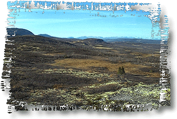
Vestre Slidre is bordered to the northwest by the municipality of Vang, to the northeast by Øystre Slidre, to the east by Nord-Aurdal, and to the southwest by Hemsedal.
Vestre Slidre is part of the Valdres region in south-central Norway. It is situated between Gudbrandsdal and Hallingdal.