
Time zone EST (UTC-5) Elevation 308 m Population 28,043 (2010) | State New York Established 1823 ZIP codes 13850-13851 Area 136.2 km² Local time Sunday 11:30 AM | |
 | ||
Weather 7°C, Wind W at 10 km/h, 60% Humidity | ||
Celebrity liam stone candid travels texas goes to vestal new york
Vestal is a town within Broome County in the Southern Tier of New York, and lies between the Susquehanna River and the Pennsylvania border. As of the 2010 census, the population was 28,043.
Contents
- Celebrity liam stone candid travels texas goes to vestal new york
- Map of Vestal NY 13850 USA
- History
- Geography
- Demographics
- Transportation
- Schools
- Shopping dining and entertainment
- Recreational areas
- Hamlets
- Other locations
- References
Map of Vestal, NY 13850, USA
Vestal is on the south border of the county and is west and southwest of Binghamton.
Vestal is home to Binghamton University which draws visitors to the town through its entertainment and sporting events. The university adds thousands of students to the town and employs more than 3,000 faculty and staff.
History
The first European settlers arrived in Vestal around 1785.
The central area of Vestal, near Route 26 at Choconut Creek, was the site of an indigenous village of the Ochugnut tribe of the Tuscarora people. During the American Revolution, a squad of soldiers from the Sixth Massachusetts Regiment, under the command of Lt. William McKendry were sent to engage the tribes, when possible, and destroy their homes and crops. During the summer of 1779, the squad did burn at least two villages without encountering resistance, including one situated in what is now nearby downtown Binghamton (the Chenango, at the confluence of the Chenango and Susquehanna rivers), and the Ochugnut (Choconut) at the site of Choconut Creek near present-day Vestal High School.
This campaign during the American Revolution was initiated following Indigenous predations against settlers, presumed to have been carried out by tribes forming part of the Iroqouis alliance. This hostile activity against settlers was encouraged by the British. However, some evidence indicates that at least some of the indigenous people were actually Tuscarora - descendants of the Cherokee who fled from North Carolina after wars in 1711 and the War of 1763. This community was actually sympathetic to the American cause, siding against the rest of the Iroquois confederation. See Sullivan Expedition or external links for more information on the role of Upstate New York in this conflict.
Following the war, several European families settled in the area near the town of Union. The town of Vestal was formed from the southern half of Union in 1823.
The history of the town is closely related to its neighbors, Binghamton, Endicott, and Johnson City. During the 20th century, Vestal served as a residential suburb to emerging industries in its area, such as Endicott Johnson Corporation, IBM, and Lockheed Martin.
In 1955, Harpur College began to plan its current location in Vestal. This move was complete by 1961. The 387-acre (1.57 km2) site was purchased from Hazard Lewis Farms, a local dairy, anticipating future growth for the school. Founded as "Triple Cities College of Syracuse University" in Endicott, the college has become Binghamton University, the highest ranked public university in the Northeastern United States. The university adds 14,000 students to the local population each school year, and draws large numbers into the town for sporting, arts and other events.
The Kopernik Observatory & Science Center is a public observatory in Vestal opened to the public on 16 June 1974 by the Kopernik Society of Broome County to commemorate the 500th anniversary of the birth of the astronomer Nicolaus Copernicus (Polish: Mikołaj Kopernik) in 1973. It is one of the best-sited and best equipped public observatories in the Northeast United States.
During the 1990s, Vestal became the major retail center of the Southern Tier region of New York, with many large shopping centers such as the Town Square Mall, Parkway Plaza, Shoppes at Vestal, and Campus Plaza being built along the Vestal Parkway (NY Route 434), which became one of the busiest roads in the area. Vestal's historic central business district is located along three blocks of Front Street, still lined with small shops.
The Drovers Inn and Round Family Residence and Vestal Central School were listed on the National Register of Historic Places in 2010.
Geography
According to the United States Census Bureau, the town has a total area of 52.6 square miles (136.2 km2). 51.7 square miles (134.0 km2) of it is land, and 0.85 square miles (2.2 km2) of it (1.62%) is water. The town of Vestal is on the south side of the Susquehanna River. The Susquehanna River flows westward past Vestal to towns like Owego and Waverly in Tioga County, New York. From there, the river bends southward into Pennsylvania through Wilkes-Barre and Harrisburg, eventually flowing into the Chesapeake Bay at Havre de Grace, Maryland.
The north town line is defined by the Susquehanna River, the west town line is the border of Tioga County, and the south town line is the border of Susquehanna County, Pennsylvania.
New York State Route 17 passes across the north part of the town and intersects north-south highway New York State Route 26 by the Susquehanna River. New York State Route 434, Vestal Parkway, intersects NY-26 south of the NY-17 junction. New York State Route 201 also crosses to the north shore of the Susquehanna River, linking the eastern part of Vestal with the village of Johnson City.
Demographics
As of the census of 2000, there were 26,535 people, 8,525 households, and 5,924 families residing in the town. In the 2010 census, the number becomes 28,043. The population density was 508.5/sq mi (196.3/km2). There were 8,898 housing units at an average density of 170.5 per square mile (65.8/km²). The racial makeup of the town was 87.13% White, 2.19% African American, 0.15% Native American, 8.33% Asian, 0.99% from other races, and 1.20% from two or more races. Hispanic or Latino of any race were 2.40% of the population.
There were 8,525 households out of which 29.6% had children under the age of 18 living with them, 59.9% were married couples living together, 7.0% had a female householder with no husband present, and 30.5% were non-families. 25.1% of all households were made up of individuals and 10.7% had someone living alone who was 65 years of age or older. The average household size was 2.45 and the average family size was 2.95.
In the town, the population was spread out with 18.9% under the age of 18, 24.0% from 18 to 24, 20.6% from 25 to 44, 20.8% from 45 to 64, and 15.8% who were 65 years of age or older. The median age was 34 years. For every 100 females there were 90.6 males. For every 100 females age 18 and over, there were 86.7 males.
The median income for a household in the town was $51,098, and the median income for a family was $60,676. Males had a median income of $48,731 versus $29,035 for females. The per capita income for the town was $22,363. About 4.3% of families and 7.1% of the population were below the poverty line, including 7.6% of those under age 18 and 5.1% of those age 65 or over.
Transportation
Vestal is linked from the west primarily by New York State Route 17, which is under development to become Interstate 86. NY 17 leads east 6 miles (10 km) to Interstate 81 and Interstate 88 in Binghamton. Two major bridges over the Susquehanna River (New York State Route 26 and New York State Route 201) and one minor bridge (Bridge Road) link Vestal to the villages of Endicott and Johnson City. New York State Route 434, the "Vestal Parkway", is the main artery through Vestal. It provides a direct link to Binghamton in the east.
Broome County Transit provides Vestal with bus service around the town and to surrounding municipalities. Greater Binghamton Airport is located about 7 miles (11 km) to the north in the town of Maine and provides direct flights to Detroit and Philadelphia.
Schools
Shopping, dining and entertainment
Recreational areas
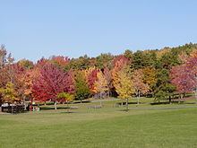
The town of Vestal has 21 town-operated and -maintained parks which cater to all ages.
- Arnold Park – Andrews Road
- African Road Park – African Road
- Barlow Park – Main Street
- Castle Gardens Park – Garden Lane
- David Avenue Park – David Avenue
- DEC Flood Fields – Main Street
- Ethel Place Park – Ethel Park
- Fuller Hollow Park – Marietta Drive
- Harold Moore Park – Old Vestal Road
- Jones Park – State Line Road
- Memorial Park – Four Corners - Rt. 434 & Front Street
- Middendorf Park – Juneberry Road
- Richards Avenue Park – Richards Avenue
- Ross Corners Park – Old Owego Road
- Stair Park – Murray Hill Road
- Stratford Park – Stratford Drive
- Twin Orchards – Myrtle Street
- Vestal Center Park – Coleman Street
- Vestal Memorial Pool – Clayton Avenue
- Willow Point Park – Gates Road
- Vestal Rail Trail
The largest park in the area is Arnold Park located off Pierce Hill Road. This park offers a newly constructed plastic playground, picnic areas, a sand volleyball court, a standard sized baseball field and three other large grassy areas, as well as a nature trail through the wooded areas surrounding the park. In October, the Recreation Department holds a Halloween event at the park. In August, the Recreation Department hosts a picnic and summer festival. The Recreational Baseball League hosts at this park a variety of competitions amongst leagues.
The Recreation Department operates the 40x20 yard Vestal Memorial Pool located on Clayton Avenue off Route 434.
Hamlets
The Town of Vestal recognizes five hamlets within its borders: