
- elevation 1,290 ft (393 m) Basin area 4,097 km² Country United States of America | - elevation 820 ft (250 m) Length 145 km Bridges Court Street Bridge | |
 | ||
- left Chenango Canal, Sangerfield River - right Callahan Brook, Electric Light Stream, Eaton Brook, Tioughnioga River - location Morrisville, Madison County, New York, United States - location Binghamton, Broome County, New York, New York, United States Mouths Susquehanna River, Tioughnioga River Sources Campbell Lakes, Morrisville Swamp | ||
Route 17 i 81 bridges over the chenango river controlled demolition inc
The Chenango River is a 90-mile-long (140 km) tributary of the Susquehanna River in central New York in the United States. It drains a dissected plateau area in upstate New York at the northern end of the Susquehanna watershed.
Contents
- Route 17 i 81 bridges over the chenango river controlled demolition inc
- Map of Chenango River North Norwich NY USA
- Chenango river smallmouth
- CourseEdit
- References
Map of Chenango River, North Norwich, NY, USA
Named after the Oneida word for bull thistle, in the 19th century the Chenango furnished a critical link in the canal system of the northeastern United States. The Chenango Canal, built from 1836–1837 between Utica and Binghamton, connected the Erie Canal in the north to the Susquehanna River. The canal was rendered obsolete by railroads and was abandoned in 1878.
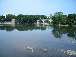
Flooding is often a concern during the spring and fall.
Chenango river smallmouth
CourseEdit
The Chenango River begins near Morrisville in Madison County, in central New York, in the Morrisville Swamp in the Town of Smithfield, about 25 miles southwest of Utica. The river flows from the Campbell Lakes in the swamp, from waters flowing in from the Smithfield Hills to the north and west and a series of cliffs called "The Ledges" to the north and east. It flows south-southeast through the swamp. From Morrisville, it flows south past Eaton and is paralleled by the remnants of the old Chenango Canal from Randallsville, just south of Hamilton, to just north of Earlville where the old canal joined the river. Continuing south the Chenango is joined by the Sangerfield River, also known as the East Branch of the Chenango, just south of Earlville. Then it flows south past Sherburne to Norwich, where it turns southwest. At Oxford it turns south, and at Warn Lake it again turns southwest. It flows past Brisben and Greene to Chenango Forks, where, about nine miles north of Binghamton, it receives from the right its major tributary, the Tioughnioga River. It ends where it joins the Susquehanna from the north in downtown Binghamton in Broome County. Its overall length is about 90 miles.