
West end: VT 78 in Swanton Counties: Franklin | Length 47.36 km West end VT 78 in Swanton | |
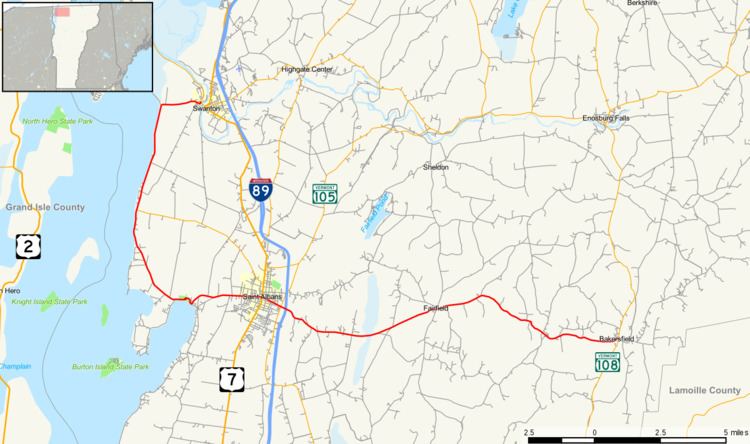 | ||
Vermont Route 36 is a state highway in Franklin County, Vermont, United States. It is an L-shaped highway running south and east from VT 78 in the village of Swanton in the north to VT 108 in the town of Bakersfield in the east. The portion from St. Albans Bay State Park to the eastern terminus in Bakersfield is maintained by the state while the north–south portion is a town highway minor collector (route number 786).
Contents
Map of VT-36, Vermont, USA
Route description
VT 36 begins at an intersection with VT 78 in the village of Swanton two blocks from VT 78's intersection with U.S. Route 7. VT 36 runs south along the eastern edge of Lake Champlain for about 5 miles (8.0 km), and then turns eastward towards the city of St. Albans. The route briefly overlaps US 7 in the center of the city, and about a half mile (0.8 km) later, intersects VT 104, a state highway providing access to Interstate 89 via exit 19. VT 36 proceeds east out of the city and into the mountains. It passes through the town of Fairfield and ends at an intersection with VT 108 in Bakersfield.
Major intersections
The entire route is in Franklin County.