
Founded 1844 | Area 3,983 km² Population 59,253 (2013) Unemployment rate 6.6% (Apr 2015) | |
 | ||
Website vermilionparishpolicejury.com Rivers Anselm Coulee, Granges Coulee, Bayou Queue De Tortue | ||
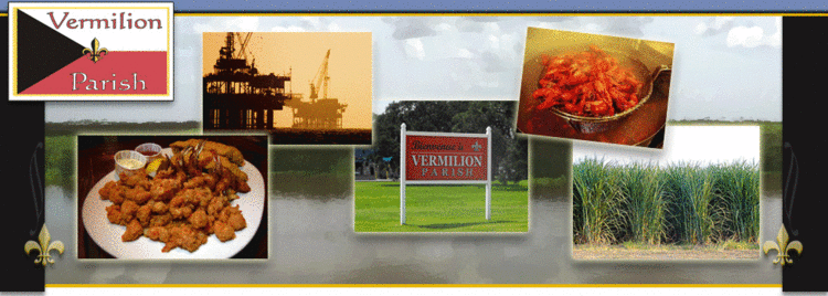
Visit vermilion parish louisiana
Vermilion Parish (Paroisse de Vermillon) is a parish located in the U.S. state of Louisiana. As of the 2010 census, the population was 57,999. The parish seat is Abbeville. The parish was created in 1844.
Contents
- Visit vermilion parish louisiana
- Map of Vermilion Parish LA USA
- History
- Geography
- Major highways
- Adjacent parishes
- Demographics
- Education
- Cities
- Towns
- Village
- References
Map of Vermilion Parish, LA, USA
Vermilion Parish is part of the Lafayette, LA Metropolitan Statistical Area.
Vermilion and neighboring Cameron parishes are represented in the Louisiana State Senate by the Republican Jonathan W. Perry of Kaplan.
In the past several decades, much of the southern portion of the parish has been swept away by water erosion, especially after Hurricane Katrina and Hurricane Rita in 2005.
History
Indigenous peoples lived in the area for thousands of years, from different cultures. By historic times, the Chitimacha and Atakapa inhabited the area and were the American Indians encountered by Spanish and French explorers and settlers. The tribes' numbers were drastically reduced as a result of exposure to European diseases to which they had no immunity.
French, Spanish, enslaved Africans, and French-Canadians from Acadia expelled after the Seven Years' War won by Great Britain, had all entered the area by the end of the 18th century. As the population became mostly Cajun, the primary language was French for years. In the mid- to late 19th century, they were joined by European Americans; immigrants from Italy, recruited to work on the plantations, as well as Jewish immigrants from Germany and eastern Europe, who tended to settle in towns and become merchants.
Geography
According to the U.S. Census Bureau, the parish has a total area of 1,542 square miles (3,990 km2), of which 1,173 square miles (3,040 km2) is land and 369 square miles (960 km2) (24%) is water. It is the fifth-largest parish in Louisiana by total area. The Gulf of Mexico is located to the south of the parish.
Major highways
Adjacent parishes
Demographics
Home to a number of Cajun peoples, as of the census of 2000, there were 53,807 people, 19,832 households, and 14,457 families residing in the parish. The population density was 46 people per square mile (18/km²). There were 22,461 housing units at an average density of 19 per square mile (7/km²). The racial makeup of the parish was 82.68% White, 14.17% Black or African American, 0.30% Native American, 1.82% Asian, 0.01% Pacific Islander, 0.26% from other races, and 0.76% from two or more races. 1.38% of the population were Hispanic or Latino of any race. 24.89% reported speaking French or Cajun French at home, while 1.64% speak Vietnamese and 1.02% Spanish.[1]
There were 19,832 households out of which 37.10% had children under the age of 18 living with them, 55.50% were married couples living together, 13.00% had a female householder with no husband present, and 27.10% were non-families. 23.10% of all households were made up of individuals and 10.90% had someone living alone who was 65 years of age or older. The average household size was 2.67 and the average family size was 3.16.
In the parish the population was spread out with 28.10% under the age of 18, 9.40% from 18 to 24, 28.20% from 25 to 44, 20.80% from 45 to 64, and 13.50% who were 65 years of age or older. The median age was 35 years. For every 100 females there were 93.90 males. For every 100 females age 18 and over, there were 89.80 males.
The median income for a household in the parish was $29,500, and the median income for a family was $36,093. Males had a median income of $31,044 versus $18,710 for females. The per capita income for the parish was $14,201. About 17.40% of families and 22.10% of the population were below the poverty line, including 30.00% of those under age 18 and 21.40% of those age 65 or over.
Education
Vermilion Parish School Board operates public schools in the parish.
The schools serving Delcambre are located in Vermilion Parish and are operated by Iberia Parish School System.