
Coat of arms Flag Towns under district jurisdiction 1 Area 137,428 km² | Country Russia Settlements 2 Founded 5 January 1967 | |
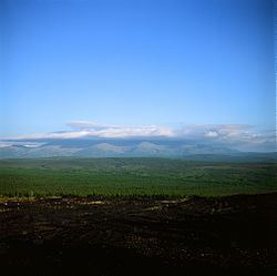 | ||
Verkhoyansky District (Russian: Верхоя́нский улу́с; Yakut: Үөһээ Дьааҥы улууһа, Üöhee Caañı uluuha, [ˈyøheː ɟaːŋɯ uluːha]) is an administrative and municipal district (raion, or ulus), one of the thirty-four in the Sakha Republic, Russia. It is located in the northern central part of the republic and borders with Ust-Yansky District in the northeast, Momsky District in the east, Tomponsky District in the south, Kobyaysky District in the southwest, Eveno-Bytantaysky National District in the west, and with Bulunsky District in the northwest. The area of the district is 137,400 square kilometers (53,100 sq mi). Its administrative center is the urban locality (a settlement) of Batagay. Population: 12,815 (2010 Census); 13,666 (2002 Census); 24,259 (1989 Census). The population of Batagay accounts for 34.1% of the district's total population.
Contents
- Map of Verkhoyanskiy u Sakha Republic Russia
- Geography
- Climate
- History
- Demographics
- Economy
- Inhabited localities
- References
Map of Verkhoyanskiy u., Sakha Republic, Russia
Geography
The main river in the district is the Yana.
Climate
Average January temperature ranges from −48 °C (−54 °F) to −38 °C (−36 °F) and average July temperature ranges from +16 °C (61 °F) to +17 °C (63 °F). Annual precipitation ranges from 150 to 300 millimeters (5.9 to 11.8 in).
History
The district was established on January 5, 1967.
Demographics
As of the 1989 Census, the ethnic composition was as follows:
Economy
The economy of the district is mostly based on agriculture. There are deposits of tin, tungsten, copper, lead, antimony, gold, silver, brown coal, and other minerals.
Inhabited localities
Divisional source:
Population source:
*Administrative centers are shown in bold