
Elevation 135 m (440 ft) Postal code 59880 Population 7,893 (2011) | District Çorlu Time zone EET (UTC+2) Licence plate 59 Area code 0282 | |
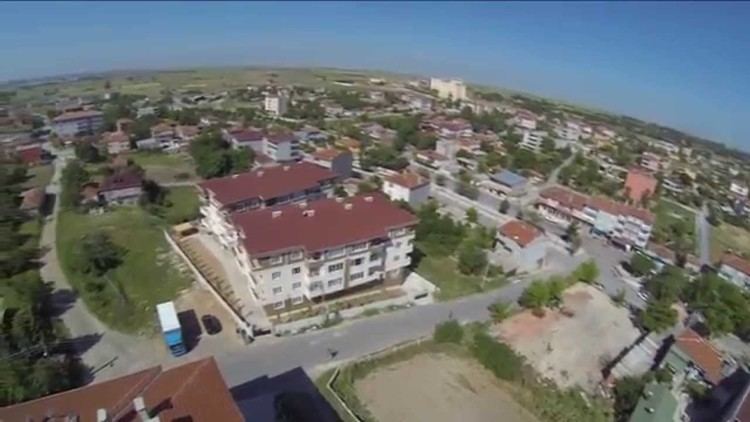 | ||
Velimeşe is a town in Tekirdağ Province, Turkey.
Contents
- Map of VelimeC59Fe VelimeC59Fe Mahallesi 59880 C387orlu2FTekirdaC49F Turkey
- Geography
- History
- Economy
- References
Map of Velime%C5%9Fe, Velime%C5%9Fe Mahallesi, 59880 %C3%87orlu%2FTekirda%C4%9F, Turkey
Geography
Velimeşe is a town in Çorlu district of Tekirdağ Province. It is situated in Rumeli (Thrace, the European part of Turkey) to the north of Çorlu Creek (a tributary of Ergene River) and motorway which connects İstanbul to Kapıkule the Bulgarian border. At 41°15′N 27°53′E the distance to Çorlu is 13 kilometres (8.1 mi) to Tekirdağ is 52 kilometres (32 mi) and to İstanbul is 110 kilometres (68 mi).The population of Velimeşe is 7893 as of 2011.
History
In the 19th century in the place of the town there was a public farm used for military training. The name of the farm was Velipaşa referring an Ottoman pasha. After the Russo-Turkish War (1877-1878) Turkish refuges from Bulgaria and Serbia were settled in the farm and the settlement was named as Velimeşe. In the early 20th century there were two temporary occupations of the settlement. In 1912 it was occupied by Bulgaria during the First Balkan War, but it was returned to Turkey during the Second Balkan War. Between 1920 and 1922 following the First World War, it was occupied by Greece. On 15 October 1922 Velimeşe was returned to Turkey. In 1974 the settlement was declared a seat of township.
Economy
Velimeşe is a flourishing town. Corn, sunflower and cereals are among the main crops. But the majority of town residents work in factories around the town.