
District Sørlandet Area rank 255 in Norway Area 355.6 km² Official language form Neutral | County Aust-Agder Demonym(s) Vegårsheiing Local time Saturday 10:39 PM | |
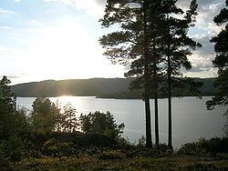 | ||
Weather 5°C, Wind W at 6 km/h, 91% Humidity Points of interest Nesstranda, LANGØYA RECREATIONAL AREA, Orrenessanden | ||
Vegårshei is a municipality in Aust-Agder county, Norway. It is located in the traditional district of Sørlandet. The administrative center is the village of Myra.
Contents
Map of Veg%C3%A5rshei, Norway
General information
The parish of Vegaardsheien was established as a municipality on 1 January 1838 (see formannskapsdistrikt). The borders of the municipality have not changed since that time.
Name
The Old Norse form of the name may have been Vigisheiðr. The first element is the genitive case of the name of the lake Vegår (the Norse form, and the meaning, of the name is uncertain). The last element is heiðr which means "heath" or "moor".
Coat-of-arms
The coat-of-arms is from modern times. They were granted on 30 April 1987. The arms show a fox as a representative of the local wildlife and also for the fox farming in the village.
Geography
Vegårshei is bordered on the north by the municipalities of Nissedal and Gjerstad, on the east by Risør, on the south by Tvedestrand, and on the west by Åmli.
Economy
Vegårshei used to be an agricultural and lumbering community.
Culture
Vegårshei is a great place for hunting and fishing.