
Area 10.75 km² Population 1,179 (1999) | Region Normandy Canton Offranville Time zone CET (UTC+1) Local time Saturday 1:15 PM | |
 | ||
Weather 13°C, Wind SW at 13 km/h, 66% Humidity Points of interest Bois des Moutiers, Manoir d'Ango, Eglise Saint Valéry, Jardin Shamrock, Musée Michel Ciry | ||
Varengeville-sur-Mer is a commune in the Seine-Maritime department in the Haute-Normandie region in north-western France.
Contents
- Map of 76119 Varengeville sur Mer France
- Geography
- Places of interest
- People
- Twinning
- In literature
- References
Map of 76119 Varengeville-sur-Mer, France
Geography
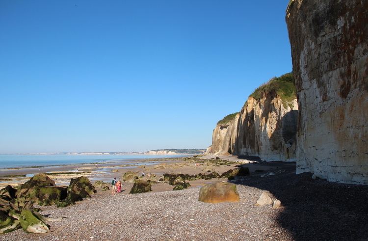
A forestry and farming commune situated by the coast of the English Channel and in the Pays de Caux, some 5 miles (8.0 km) west of Dieppe at the junction of the D27, D75 and the D123 roads. The commune has access to the pebble beach by means of a gap in the huge chalk cliffs.
Places of interest
People
Twinning
The village is twinned with Herstmonceux in East Sussex, in the United Kingdom
In literature
Naomi Mitchison, in her autobiographic book "You may well ask", relates that in the 1920s and 1930 she and her family, along with other families of their social circle in London, used to have vacations in Varengeville: "At the small village of Varengeville, on top of the cliffs a few miles west of Dieppe, the families with children lived in fairly basic chalets which were fine for us. We ate at the hotel and went down a steep path to the sand and rather chilly swimming, and tremendously enjoyed each other's company".