
Country Language spoken District Tiruvanamalai | State | |
 | ||
University Thiruvalluvar College of Engineering and Technology | ||
Map of Vandavasi
Vandavasi or Wandiwash is a city and a municipality in Tiruvannamalai district in the Indian state of Tamil Nadu. As of 2011, the town had a population of 31,320.
Contents
- Map of Vandavasi
- Divya opticals vandavasi
- Thoguthi arivom vandavasi puthiyatalaimurai tv
- Geography and climate
- Demographics
- As a capital town
- Places of interest
- Politics
- References
Vandavasi was the scene of a decisive battle in the 18th-century war between France and the United Kingdom for the control of South Asia. The Battle of Wandiwash was a watershed in Indian history as it cemented British supremacy in South Asia. On January 22, 1760, a British force led by Eyre Coote defeated a French force led by General Thomas Lally.
Divya opticals vandavasi
Thoguthi arivom vandavasi puthiyatalaimurai tv
Geography and climate
Vandavasi is located at 12.5°N 79.62°E / 12.5; 79.62. It lies 110 kilometres South-West of Chennai City, South of famous temple city Kanchipuram and 80 km north-east of Thiruvannamalai. The town is well connected with Chennai by road.It has an average elevation of 74 metres (242 feet). Vandavasi climatic condition is similar to that of Chennai, lying on the thermal equator and close to the coast, most part of the year climate is hot and humid.
Demographics
According to 2011 census, Vandavasi had a population of 31,320 with a sex-ratio of 1,012 females for every 1,000 males, much above the national average of 929. A total of 3,337 were under the age of six, constituting 1,740 males and 1,597 females. Scheduled Castes and Scheduled Tribes accounted for 13.54% and 1.31% of the population respectively. The average literacy of the town was 77.3%, compared to the national average of 72.99%. The town had a total of : 7326 households. There were a total of 10,553 workers, comprising 152 cultivators, 302 main agricultural labourers, 309 in house hold industries, 9,093 other workers, 697 marginal workers, 8 marginal cultivators, 27 marginal agricultural labourers, 52 marginal workers in household industries and 610 other marginal workers. As per the religious census of 2011, Vandavasi had 60.86% Hindus, 34.73% Muslims, 3.03% Christians, 0.02% Sikhs, 0.0% Buddhists, 1.28% Jains, 0.08% following other religions and 0.0% following no religion or did not indicate any religious preference.
As a capital town
According to one version, Chennapattanam, now called Chennai (British Madras), was named after Damera Chennappa Nayaka, the Nayaka of Kalahasthi and Vandavasi, father of Damera Venkatappa Kayaker (padmanayaka velama ruler) from whom the English acquired the town in 1639. The ruler of the area, Chennapa Nayak, the Nayaka of Vandavasi, granted the British permission to build a factory and warehouse for their trading enterprises. The region was then primarily a fishing village known as "Madraspatnam".
Places of interest
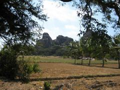
Vandavasi fort would have been a famous tourist spot but for its negligence by the authorities. It witnessed the decisive Battle of Wandiwash, it even is said to have an underground passage to Gingee fort. The Nayak of Vandavasi, a vassal of Vijaynagara Kings was instrumental in helping British secure grant from Chandragiri Fort to build the city of Madras.
Arahanthgiri Jain Math is a Jain Math that was established at the ancient Jain site of Tiruvannamalai in August 1998. The complex includes 3 Jain caves, 4 Jain temples and a 16-meter high sculpture of Neminatha thought to date from the 12th century that is the tallest Jain image in Tamil Nadu.
Politics
Vandavasi assembly constituency is part of Arni (Lok Sabha constituency).