
Flag Coat of arms Population 899,532 (2014) | Time zone CET (UTC+1) Area 583.1 km² | |
 | ||
Municipalities ListBarberà del Vallès, Castellar del Vallès, Castellbisbal, Cerdanyola del Vallès, Gallifa, Matadepera, Montcada i Reixac, Palau-solità i Plegamans, Polinyà, Rellinars, Ripollet, Rubí, Sabadell, Sant Cugat del Vallès, Sant Llorenç Savall, Sant Quirze del Vallès, Santa Perpètua de Mogoda, Sentmenat, Terrassa, Ullastrell, Vacarisses, Viladecavalls Colleges and Universities Autonomous University of Barcel, ESDi School of Design, Facultat de Veterinària Points of interest Monastery of Sant Cugat, Sant Llorenç del Munt, Sabadell History Museum, Sabadell Art Museum, Parc Catalunya | ||
Vallès Occidental is a comarca (county) in Catalonia, Spain. It is unique among the comarques in that the two cities Sabadell and Terrassa (which are of roughly equal size) share the role of comarcal capital. Along with Vallès Oriental it forms the grand comarca of Vallès.
Contents
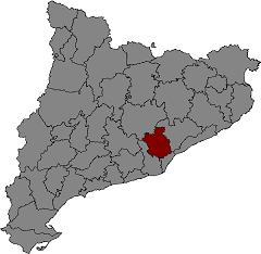
- Map of El VallC3A8s Occidental Barcelona Spain
- Physical geography
- Major natural parks
- Hiking trails
- Human and economic geography
- Transportation
- Motorways
- Highways
- Railroads
- Airports
- References
Map of El Vall%C3%A8s Occidental, Barcelona, Spain
Physical geography
Vallès Occidental borders the comarques of Bages (to the north), Vallès Oriental (to the north and east), Baix Llobregat (to the west), and Barcelonès (to the south). It centers on the Catalan prelittoral depression, limited to the west by the River Llobregat and to the east by the River Caldes. The northern part of the comarca is mountainous. From west to east, it contains part of the Obac range (924m altitude at Castellsapera); the massifs of Sant Llorenç de Munt (1095m at La Mola and 1053m at Montcau) and Puig de la Creu (664m); and the Sant Sadurní (954m) and Farell cliffs (789m). At the south of the comarca is the Collserola range (512m), which forms part of the Catalan Littoral. Between these various ranges is the valley that gives its name to the comarca. The valley actually composes two separate watersheds, the basins of the Llobregat and Besòs.
The Llobregat watershed lies to the west of the axis that runs from Obac to Tibidabo (culminating point of the Collserola range), passing through Matadepera, Sant Quirze del Vallès, Bellaterra, and Sant Cugat del Vallès. Tributaries of the Llobregat include the Canyamssos, the Rubí and the Vallvidrera. East of that axis, the watershed of the Besòs includes the rivers Ripoll and Caldes, (the latter forming the eastern border of the comarca).
Major natural parks
Hiking trails
Vallès Occidental has several notable official hiking trails, known as "senders de gran recorregut".
Human and economic geography
Industry is concentrated in the south, coinciding with the flattest land in the comarca. The principal industrial cities are the co-capitals (Sabadell and Terrassa), Rubí and Cerdanyola del Vallès. The most important industries are textiles, mechanical engineering, metallurgy, machinery, electrical equipment, construction, chemicals, paper, and the processing of food products. An industrial crisis at the end of the 1970s and the beginning of the 1980s led to a greater importance for the commercial and service sectors, especially computer-related work.
The north remains primarily rural. Many of the residences there now function as second homes.
Transportation
Much of Catalonia's transportation network passes through Vallès Occidental, with roads, railroads, etc. crossing the valley in various directions.
Motorways
Highways
Railroads
Both railroad companies that operate in Catalonia have lines in Vallès Occidental. RENFE's Barcelona-Lleida line passes through Manresa. The Ferrocarrils de la Generalitat de Catalunya have the "Metro del Vallès", connecting Barcelona to Sabadell and Terrassa.
Airports
Most air traffic for Vallès Occidental comes through Prat airport in neighboring Baix Llobregat. Sabadell Airport is used for sport flying, as a base for firemen, and for air freight.