
Country United States Area code(s) 402 Elevation 787 m Population 2,789 (2013) | Time zone Central (CST) (UTC-6) FIPS code 31-49950 Zip code 69201 Local time Monday 11:43 PM | |
 | ||
Weather 3°C, Wind W at 14 km/h, 86% Humidity | ||
Valentine is a city in Cherry County, Nebraska, United States. The population was 2,737 at the 2010 census. It is the county seat of Cherry County.
Contents
- Map of Valentine NE 69201 USA
- History
- Geography
- Climate
- 2010 census
- 2000 census
- Education
- Notable people
- Culture
- References
Map of Valentine, NE 69201, USA
History
Valentine was founded in 1883 when the Sioux City and Pacific Railroad was extended to that point. It was named for Edward K. Valentine, a Nebraska representative.
Valentine participates in an annual re-mailing program where thousands of pieces of mail flow into the local United States Post Office so that they can be re-mailed with a special Valentine's Day postmark and verse.
In 2007, National Geographic Adventure magazine included Valentine in its list of the best ten wilderness towns and cities.
In the Lakota language, Valentine is known as Oínažiŋ or Mnináȟaȟa Otȟúŋwahe, meaning "station stopping place" or "water and waterfall city".
Geography
Valentine is located at 42°52′25″N 100°33′1″W (42.873686, −100.550308). According to the United States Census Bureau, the city has a total area of 2.25 square miles (5.83 km2), of which, 2.22 square miles (5.75 km2) is land and 0.03 square miles (0.08 km2) is water.
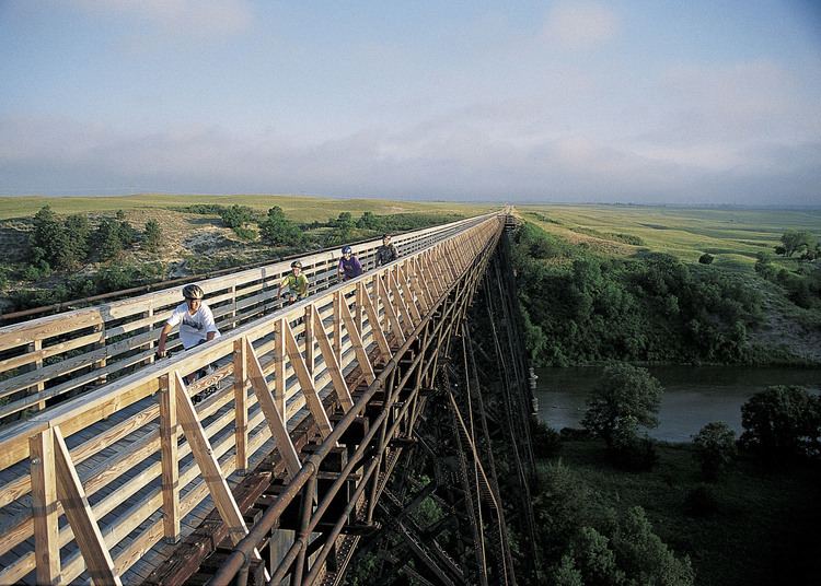
Valentine is immediately north of the Niobrara River, on the northern edge of the Sandhills physiographic region. Merritt Reservoir, created by a dam on the Snake River, is located about 48 km (30 mi) southwest of Valentine. Snake River Falls, the largest waterfall in Nebraska, is located on the Snake River between the reservoir (a few miles downstream) and Valentine. Smith Falls, the tallest waterfall in Nebraska, is located on a small stream tributary to the Niobrara River about 15 miles (24 km) east of Valentine in Smith Falls State Park.
Just south of Valentine, a pair of bridges span the Niobrara River. The modern bridge carries traffic north and south along U.S. Route 83. Just to the west, an arched cantilever truss bridge named the Bryan Bridge is also open to through traffic. Designed by Josef Sorkin and built in 1932, the Bryan Bridge is made of steel and is listed on the National Register of Historic Places. A large red neon heart (a star during the Christmas season) is found on the pine-covered Minnechaduza Creek canyon wall at the north end of Main Street.
Climate
With a humid continental climate (Köppen Dwa), Valentine experiences extremes of heat and cold annually; it is part of USDA Hardiness zone 4b. The normal monthly mean temperature ranges from 23.6 °F (−4.7 °C) in January to 74.5 °F (23.6 °C) in July. On average, there are 6.7 days that reach 100 °F (38 °C) or higher, 41 days that reach 90 °F (32 °C) or higher, 42 days that do not climb above freezing, and 21 days with a low of 0 °F (−18 °C) or below. The average window for freezing temperatures is September 25 thru May 11, allowing a growing season of 136 days. Extreme temperatures officially range from −39 °F (−39 °C) on December 22, 1989 to 114 °F (46 °C) on July 2, 1990, with temperatures reaching 110 °F (43 °C) as recently as July 21, 2012; the record cold daily maximum is −17 °F (−27 °C) on January 12, 1916, while, conversely, the record warm daily minimum is 81 °F (27 °C) on July 24, 1940 and July 25, 1899.
Precipitation is low, with an annual average of around 20 in (508 mm), but not quite low enough for the climate here to be classified as semi-arid; it has ranged from 10.14 in (258 mm) in 1894 to 32.68 in (830 mm) in 1977. Snowfall averages 33.3 in (85 cm) per season (peaking in February and March), and has historically ranged from 12.7 in (32 cm) in 1984–85 to 88.5 in (225 cm) in 1919–20; the average window for measurable (≥0.1 in or 0.25 cm) snowfall is October 27 thru April 11, with May snow being rare.
2010 census
As of the census of 2010, there were 2,737 people, 1,259 households, and 719 families residing in the city. The population density was 1,232.9 inhabitants per square mile (476.0/km2). There were 1,430 housing units at an average density of 644.1 per square mile (248.7/km2). The racial makeup of the city was 86.3% White, 0.1% African American, 9.1% Native American, 0.5% Asian, 0.7% from other races, and 3.3% from two or more races. Hispanic or Latino of any race were 1.6% of the population.
There were 1,259 households of which 24.5% had children under the age of 18 living with them, 43.6% were married couples living together, 10.0% had a female householder with no husband present, 3.5% had a male householder with no wife present, and 42.9% were non-families. 38.6% of all households were made up of individuals and 18.6% had someone living alone who was 65 years of age or older. The average household size was 2.13 and the average family size was 2.78.
The median age in the city was 46 years. 21.3% of residents were under the age of 18; 6.3% were between the ages of 18 and 24; 21.2% were from 25 to 44; 27.2% were from 45 to 64; and 24% were 65 years of age or older. The gender makeup of the city was 47.2% male and 52.8% female.
2000 census
As of the census of 2000, there were 2,820 people, 1,209 households, and 733 families residing in the city. The population density was 1,401.1 people per square mile (541.7/km²). There were 1,373 housing units at an average density of 682.2 per square mile (263.7/km²). The racial makeup of the city was 92.20% White, 0.04% African American, 5.78% Native American, 0.57% Asian, 0.21% from other races, and 1.21% from two or more races. Hispanic or Latino of any race were 0.89% of the population.
There were 1,209 households out of which 28.6% had children under the age of 18 living with them, 47.8% were married couples living together, 9.9% had a female householder with no husband present, and 39.3% were non-families. 36.1% of all households were made up of individuals and 17.8% had someone living alone who was 65 years of age or older. The average household size was 2.27 and the average family size was 2.95.
In the city, the population was spread out with 26.0% under the age of 18, 6.7% from 18 to 24, 24.0% from 25 to 44, 21.8% from 45 to 64, and 21.6% who were 65 years of age or older. The median age was 40 years. For every 100 females there were 87.1 males. For every 100 females age 18 and over, there were 80.8 males.
The median income for a household in the city was $47,639, and the median income for a family was $52,632. Males had a median income of $38,188 versus $24,636 for females. The per capita income for the city was $22,715. About 1.6% of families and 6.4% of the population were below the poverty line, including 0% of those under age 18 and 16.0% of those age 65 or over.
Education
Notable people
Culture
In 2011/2012, an independent feature film, The Aviation Cocktail, had its principal photography in Valentine.