
Comarca Valencia de Alcántara Time zone CET (UTC+1) Area 595 km² | Elevation(AMSL) 620 m (2,030 ft) Postal code 10500 Population 5,786 (2014) Local time Tuesday 6:57 AM | |
 | ||
Weather 12°C, Wind W at 5 km/h, 72% Humidity | ||
Valencia de alca ntara capital de la raya hispanolusa
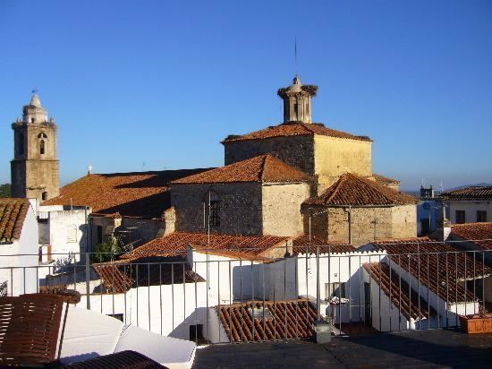
Valencia de Alcántara (Population: 6178) is a municipality located in the province of Cáceres, in the autonomous community of Extremadura, Spain. It is near the Portuguese border (District of Portalegre).
Contents
- Valencia de alca ntara capital de la raya hispanolusa
- Map of 10500 Valencia de AlcC3A1ntara CC3A1ceres Spain
- Valencia de alc ntara 2017 cabalgata de reyes magos
- Battle of 1762
- Famous inhabitants
- References
Map of 10500 Valencia de Alc%C3%A1ntara, C%C3%A1ceres, Spain
The beginning of the nineteenth century, traditionally associated with the beginnings of the modern age, is particularly troublesome in the case of Valencia de Alcántara that will be wrapped in two conflicts of deep draft, like the fleeting conflict known as the War of the Oranges (1801) or the War of Independence.
Nuestra Señora de Rocamador is the most important church. Valencia de Alcántara is a very important centre of dolmens in Europe.
Valencia de alc ntara 2017 cabalgata de reyes magos
Battle of 1762
The Battle of Valencia de Alcántara took place in 1762 as part of the Spanish invasion of Portugal. Portuguese-British troops under John Burgoyne attacked and captured the town, which was a Spanish supply base - setting back the invasion and contributing to the general British victory that year.
Famous inhabitants
It was the birthplace of Pedro Gómez Labrador, Marquis of Labrador, who represented Spain at the Congress of Vienna (1814–1815).
Soraya Arnelas was also born here.