
Postal code 1637, 1654 Area 112.2 km² Sfos number 2163 | District Gruyère District | |
 | ||
Surrounded by Bas-Intyamon, Broc, Château-d'Œx (VD), Crésuz, Grandvillard, Gruyères, Jaun, Plaffeien, Rougemont (VD), Saanen (BE) Website www.val-de-charmey.ch SFSO statistics | ||
Val-de-Charmey is a municipality in the district of Gruyère in the canton of Fribourg in Switzerland. On 1 January 2014 the former municipalities of Cerniat and Charmey merged into the municipality of Val-de-Charmey.
Contents
- Map of Val de Charmey Switzerland
- History
- Geography
- Demographics
- Historic population
- Heritage sites of national significance
- References
Map of Val-de-Charmey, Switzerland
History
Cerniat is first mentioned in 1288 as Sernia. Charmey is first mentioned in 1211 as Chalmeis. Until 1760 it was known as Feiguières. The municipality is also informally known by its German name Galmis.
Geography
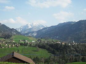
The former municipalities that now make up Val-de-Charmey have a total combined area of 112.15 km2 (43.30 sq mi).
Demographics
The total population of Val-de-Charmey (as of December 2015) is 2,416.
Historic population
The historical population is given in the following chart:
Heritage sites of national significance
The Chartreuse De La Valsainte, the alpine chalet at Le Lapé 320 and the alpine chalet at Pra de La Monse 249 are listed as Swiss heritage site of national significance.