
Country Switzerland SFOS number 3847 Local time Tuesday 1:38 AM Postal code 7537 | Canton Graubünden Elevation 1,375 m Population 1,641 (31 Dec 2008) | |
 | ||
Website www.muenstertal.ch SFSO statistics Weather 7°C, Wind NW at 8 km/h, 79% Humidity | ||
Val Müstair is a municipality in the Engiadina Bassa/Val Müstair Region in the Swiss canton of Graubünden. It was formed on 1 January 2009 through the merger of Tschierv, Fuldera, Lü, Valchava, Santa Maria Val Müstair and Müstair.
Contents
- Map of 7536 Val MC3BCstair Switzerland
- Demographics
- Geography
- Naming convention
- Language
- Heritage sites of national significance
- Weather
- Tourism
- References
Map of 7536 Val M%C3%BCstair, Switzerland
Demographics
Val Müstair has a population (as of 31 December 2015) of 1,539.
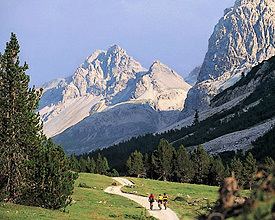
Geography
The Val Müstair (German: Münstertal, Italian: Val Monastero) is a mountain valley in the Swiss Alps. It connects the Fuorn Pass, (2,149 m (7,051 ft)) with the Italian province of South Tyrol and the Vinschgau (914 m (2,999 ft)).
The Benedictine Convent of Saint John at Müstair (monastery), a World Heritage site, was probably founded by Charlemagne, sharing history with its neighbor, the Marienberg Abbey.
The most important villages in the Val Müstair are: Tschierv (1,660 m (5,450 ft)), Valchava (1,412 m (4,633 ft)), Sta. Maria (1,375 m (4,511 ft)), Müstair (1,247 m (4,091 ft)) (all Swiss) and Taufers im Münstertal in South Tyrol. There are no other inhabited connected valleys, but the road over the Umbrail Pass (and the Stelvio Pass) is connected with Sta. Maria.
The largest part of the valley is part of the Swiss canton of Graubünden. A small part lies within the Italian province of South Tyrol. The border is located at approximately 1245 meter between Müstair (1247 meter) and Taufers im Münstertal (1240 meter).
The river in the valley is the Rom (Il Rom or Rombach).
Naming convention
Contrary to the common notion, where the beginning of a valley is referred as the "upper valley" and the end as the "lower valley", in Val Müstair these are referred to as "inner" and "outer" respectively. This is often reflected in location names.
For instance, the valley is traditionally divided into three thirds:
Incidentally, this division corresponds to the first three plateaus occurring on the Swiss part of the valley.
Language
The majority of the population in the new municipality speaks Romansh, with a large German speaking minority. The following table lists the historical language distribution of the formerly independent municipalities and also for the combined municipality:
Heritage sites of national significance
The Benedictine Convent of Saint John is both listed as a Swiss heritage site of national significance and a UNESCO World Heritage Site.
Weather
Müstair village has an average of 86.7 days of rain per year and on average receives 690 mm (27 in) of precipitation. The wettest month is August during which time Müstair receives an average of 86 mm (3.4 in) of precipitation. During this month there is precipitation for an average of 9.3 days. The month with the most days of precipitation is May, with an average of 10, but with only 80 mm (3.1 in) of precipitation. The driest month of the year is February with an average of 33 mm (1.3 in) of precipitation over 9.3 days.
The higher elevation village of Sta. Maria Val Müstair has an average of 94.6 days of rain per year and on average receives 801 mm (31.5 in) of precipitation. The wettest month is August during which time Sta. Maria Val Müstair receives an average of 105 mm (4.1 in) of precipitation. During this month there is precipitation for an average of 10.6 days. The driest month of the year is February with an average of 34 mm (1.3 in) of precipitation over 10.6 days.
Tourism
There is a small amount of car parking in the village. It is the starting point for a lot of beautiful hiking trails in both summer and winter, up in the hills or down in the valley. In fall 2009 - the International Year of Astronomy - the new public observatory Alpine Astrovillage Lü-Stailas was inaugurated. The center is equipped with top-class robotic telescopes for direct observations, as well as for astrophotography. The equipment is also used to provide introductory courses for amateur astronomers. The Astrovillage is located on a terrace at an elevation of 2,000 m (6,400 ft).