 | ||
Steil wild und rau das calancatal srf bi de l t wunderland vom 6 juni 2014
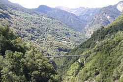
The Val Calanca is a valley of the Swiss Alps, located in the Lepontine Alps. The valley is drained by the Calancasca, a tributary of the Moesa (Ticino basin), at Roveredo. The highest mountains surrounding the Val Calanca are the Puntone dei Fraciòn (3,202 metres) and the Zapporthorn (3,152 metres).
Contents
- Steil wild und rau das calancatal srf bi de l t wunderland vom 6 juni 2014
- Map of Val Calanca 6546 Calanca Switzerland
- References
Map of Val Calanca, 6546 Calanca, Switzerland
The valley belongs to the Moesa District, in the Swiss canton of Graubünden. The main villages are (from north to south): Rossa, Cauco, Selma, Arvigo, Buseno and Santa Maria in Calanca.
References
Val Calanca Wikipedia(Text) CC BY-SA
