
Primary outflows Utikuma River Max. length 16.9 km (10.5 mi) Surface area 288 km (111 sq mi) Surface elevation 641 m Length 16.9 km Catchment area 2,170 km² | Max. width 27.1 km (16.8 mi) Area 288 km² Mean depth 1.7 m Width 27.1 km | |
 | ||
Location | ||
Land rover after utikuma lake alberta
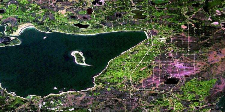
Utikuma Lake is a large lake in north-central Alberta, Canada. It is located 30 km (19 mi) north of the Lesser Slave Lake, between the Bicentennial Highway and Highway 750.
Contents
Map of Utikuma Lake, Alberta, Canada
It has a total surface of 288 km2 (111 sq mi) with 15.3 km2 (5.9 sq mi) island area. The shallow lake (maximum depth is 5.5 m (18 ft)) lies at an elevation of 648 m (2,126 ft). It is drained by the Utikuma River and then Wabasca River to Peace River.
The name Uticuma is Cree for "big whitefish".
The Utikoomak Lake 155 indian reserve of the Whitefish Lake First Nations is established on the northern shore.
References
Utikuma Lake Wikipedia(Text) CC BY-SA