
Length 91.85 km | ||
 | ||
Existed: 1920s as SR-15; renumbered in 1977 – present East end: US-89 at Mt. Carmel Junction Counties Washington County, Kane County | ||
State Route 9 (SR-9) is a state highway in southern Utah, serving Zion National Park. It starts at the western terminus at exit 16 on I-15, passing through Zion National Park, and ending at the eastern junction with US-89. The entire length of the highway has been designated the Zion Park Scenic Byway. There is a fee to travel through Zion National Park, but the Zion-Mt. Carmel Highway is open to private vehicles year-round. A separate fee is required for vehicles 7'10" wide and/or 11'4" tall or larger. This fee pays for a park employee to stop traffic from the other side of the Zion - Mt. Carmel Tunnel to allow the larger vehicles to pass through. There is a smaller tunnel in Zion National Park that does not require an escort. Commercial vehicles are prohibited from using SR-9 and are directed to use SR-20 instead.
Contents
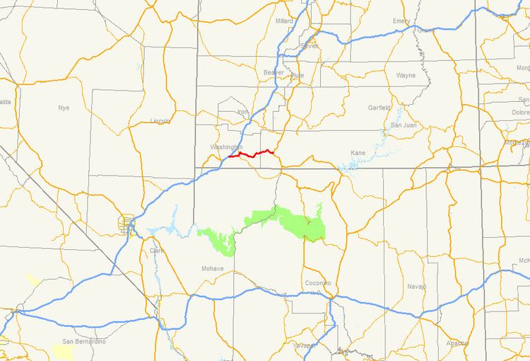
- Map of UT 9 Utah USA
- St George to Zion National Park
- Zion National Park to Mount Carmel Junction Utah
- History
- References
Map of UT-9, Utah, USA
St. George to Zion National Park
SR-9 begins at I-15, Exit 16, at Harrisburg Junction, just north of St. George. Immediately upon exiting I-15, SR-9 enters the Coral Canyon Development, which features an 18-hole golf course. Coral Canyon is split by the city boundaries of Hurricane and Washington Cities. Upon leaving this development, SR-9 passes through two ridges and begins its descent into the aptly named Purgatory Flats, home of the County Fairgrounds and a penitentiary. The 'flats' are a relatively level area between two sharply defined ridges. Quail Lake, which is in fact a reservoir, lies about a mile to the north of the road between these two ridges. Upon passing through the second ridge, SR-9 crosses the Virgin River & climbs a small plateau to the region of Hurricane known as Brentwood. The road descends from this plateau into downtown Hurricane, where SR-59 splits to the south and the Arizona Border. SR-9 then swings north towards the town of La Verkin, crossing an old bridge over the La Verkin River Ravine, before entering that town. In La Verkin, SR-17 takes off to the north, where it meets back up with I-15. After leaving La Verkin, SR-9 heads uphill and passes several mesas before eventually going through the small towns of Virgin, Rockville and Springdale.
Zion National Park to Mount Carmel Junction, Utah
This scenic section of SR-9 twists and turns along 14 miles (23 km) through Zion National Park and then another 12 miles to Mount Carmel Junction. This section of the road is called the Zion-Mount Carmel Highway and the section through the park is effectively a toll road requiring park access fees. The highway begins on the south side of Zion National Park following along the North Fork of the Virgin River. The road then turns at the junction of Pine Creek and the North Fork of the Virgin River and continues up Pine Creek Canyon, up the switchbacks and into the Zion-Mt. Carmel Tunnel. On the east side of the tunnel the highway continues through impressive scenery, past the Canyon Overlook Trailhead, the East Rim Trailhead and the unique Zion landmark, Checkerboard Mesa. Finally the road exits the park through the east entrance and 12 miles (19 km) later ends at the junction of SR-9 and US-89 in Mount Carmel Junction.
History
The road from Hurricane north through La Verkin to US-91 at Anderson Junction was added to the state highway system in 1912, and a branch was added from La Verkin Junction east to Zion National Park in 1916 and beyond to Mt. Carmel Junction in 1923. In the 1920s, the State Road Commission assigned State Route 15 to the road from Anderson Junction to the park, while State Route 16 included the branch to Hurricane (and continued southeast to Arizona via present SR-59). In 1927, the state legislature extended SR-15 through the park to Mt. Carmel Junction, and added a new State Route 17, which formed a cutoff from US-91 at Harrisburg Junction east to Hurricane. SR-17 also included SR-16 from Hurricane north to La Verkin Junction and southeast to Big Plain Junction, where the realigned SR-16 turned north to SR-15 at Rockville. The portion of SR-17 from Hurricane to Big Plain Junction was split off as SR-59 in 1931, leaving SR-15 and SR-17 as a loop off US-91 through Hurricane and La Verkin, with SR-15 continuing east through Zion National Park.
Construction began through and east of the national park in 1927, on the portion that had been added to the state highway system in 1923 and to SR-15 in 1927. The Nevada Construction Company completed the Zion-Mt. Carmel Tunnel in 1930, after three years of construction and a cost of $1,896,000. SR-15 and SR-17 were swapped in 1969, giving SR-15 the route from Harrisburg Junction and SR-17 its present route. In the 1977 renumbering, SR-15 was renumbered SR-9 due to the existence of Interstate 15.