
Existed: 1975 – present Constructed 1975 | Length 4.23 km | |
 | ||
North end: SR-12 at Tropic Junction | ||
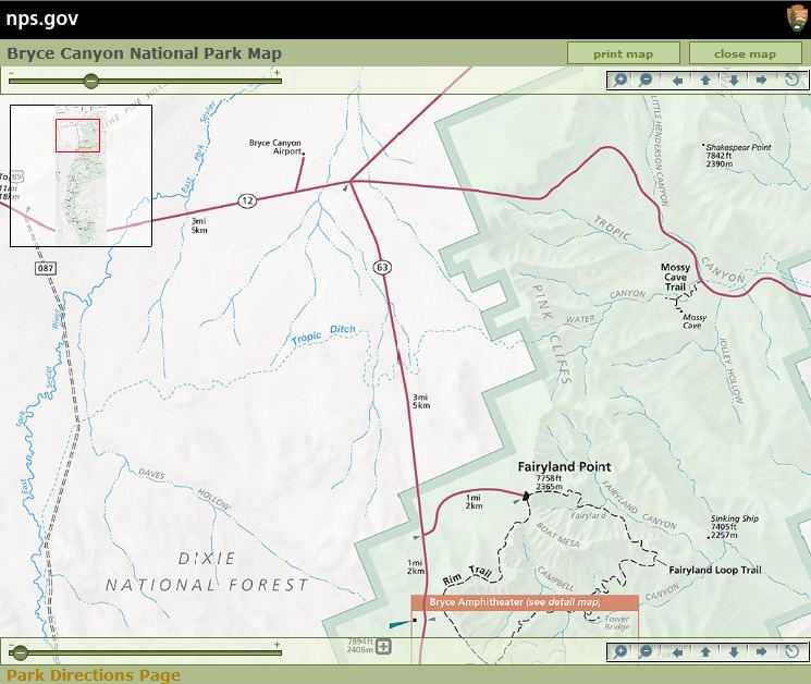
Utah State Route 63 (SR-63) is a state highway in the U.S. state of Utah. Just 2.63 miles (4.23 km) long, it serves as a connection between Utah State Route 12 (a scenic byway) and Bryce Canyon National Park.
Contents
- Map of UT 63 Bryce UT 84764 USA
- Route description
- Previous designation
- Current designation
- Major intersections
- References
Map of UT-63, Bryce, UT 84764, USA
Route description
Starting from the northern edge of Bryce Canyon National Park, the route runs northward, passing a view area, and exiting Dixie National Forest within the first mile. It continues north until its terminus at the intersection with SR-12 less than two miles later.
Previous designation
This route number was originally in use from 1931 – 1971 as a route from Salina to Scipio. The route number was withdrawn when this route was transferred to SR-26, and subsequently designated as part of US-50.
Current designation
Utah State Route 12 originally had a short spur serving Bryce Canyon. This spur was split off into a distinct highway, SR-63, in 1975.
Major intersections
The entire route is in Garfield County.