
Existed: 1931 – present Constructed 1931 | West end: SR-114 in Orem Length 7.205 km | |
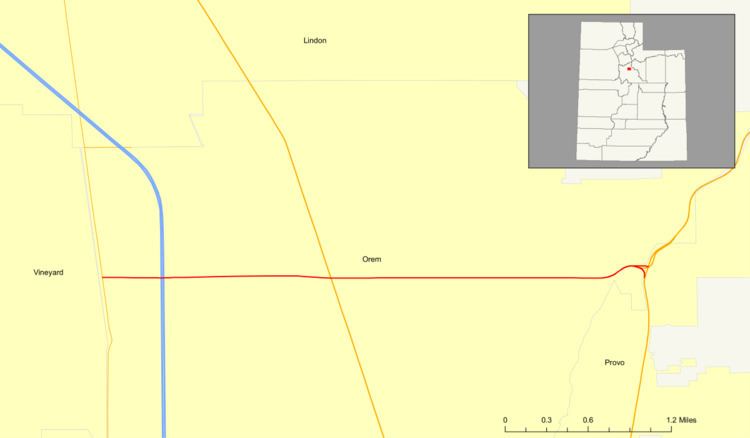 | ||
State Route 52 (SR-52) is a state highway in the U.S. state of Utah, connecting I-15 with US-189 along Orem's 800 North.
Contents
Map of UT-52, Orem, UT, USA
The road became a state highway in 1923, and was numbered as a spur of SR-7 in 1927 before being assigned its own number (52). The west end was at US-89 until 1959, when it was extended to I-15; a further extension took it to SR-114 in 1964.
Route description
SR-52 begins at SR-114 in western Orem, across from the former Geneva Steel Plant, which was on the shore of Utah Lake. For its entire length, SR-52 gradually ascends through the Utah Valley along 800 North, ending at US-189 where the valley gives way to the Wasatch Range and that highway enters Provo Canyon. A mid-1980s flyover takes traffic directly from SR-52 onto US-189 north in the canyon.
SR-52 is in the National Highway System as a connection between I-15 and US-189. A project to widen about half the length of the road through Orem from four to six lanes was completed in October 2008.
History
The road from SR-1 (US-91, now US-89) in Orem east to SR-7 (now US-189) at the mouth of Provo Canyon became a state highway in 1923. It was numbered as a spur of SR-7 in 1927, but in 1931 it was split off as State Route 52. In order to serve the planned Interstate 15, SR-52 was extended west to that road in 1959, and in 1964 the extension was continued to SR-114 (simultaneously with a similar extension of SR-265).
Major intersections
The entire route is in Orem, Utah County.