
Coat of arms Flag Rural okrugs 21 Area 18,276 km² | Country Russia Rural localities 35 Founded 9 January 1930 | |
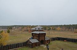 | ||
Ust-Aldansky District (Russian: Усть-Алда́нский улу́с; Yakut: Уус-Алдан улууһа, Uus-Aldan uluuha, [uːs-aldan uluːha]) is an administrative and municipal district (raion, or ulus), one of the thirty-four in the Sakha Republic, Russia. It is located in the center of the republic and borders with Kobyaysky District in the north, Tomponsky District in the northeast, Tattinsky District in the east, Churapchinsky District in the southeast, Megino-Kangalassky District in the south, and with Namsky District in the west. The area of the district is 18,300 square kilometers (7,100 sq mi). Its administrative center is the rural locality (a selo) of Borogontsy. Population: 22,155 (2010 Census); 22,372 (2002 Census); 21,389 (1989 Census). The population of Borogontsy accounts for 23.6% of the district's total population.
Contents
Geography
The landscape of the district is mostly flat. Its main rivers include the Lena and the Aldan. There are many lakes in the district, the largest of which are Lakes Myuryu, Oner, and Targyldzhyma.
History
The district was established on January 9, 1930.
Demographics
As of the 1989 Census, the ethnic composition was as follows:
Economy
The economy of the district is mostly based on agriculture.
Inhabited localities
Divisional source:
Population source:
*Administrative centers are shown in bold